
Khibiny. Useful information for an independent trek
- Khibiny. Useful information for an independent trek
- Why you should go to the Khibiny
- Relief and features of the Khibiny
- Maps, route
- Weather. Best season for trekking
- Transport, how to get to the Khibiny
- Communication on the route
- Gas and fire
- Water
- Danger
- Registration with the Emergencies Ministry
- Features of camping in a tent
- View other articles on the Khibiny:
I've been to the Khibiny in June, August, and September. Here is all the useful information for preparing an independent trek.
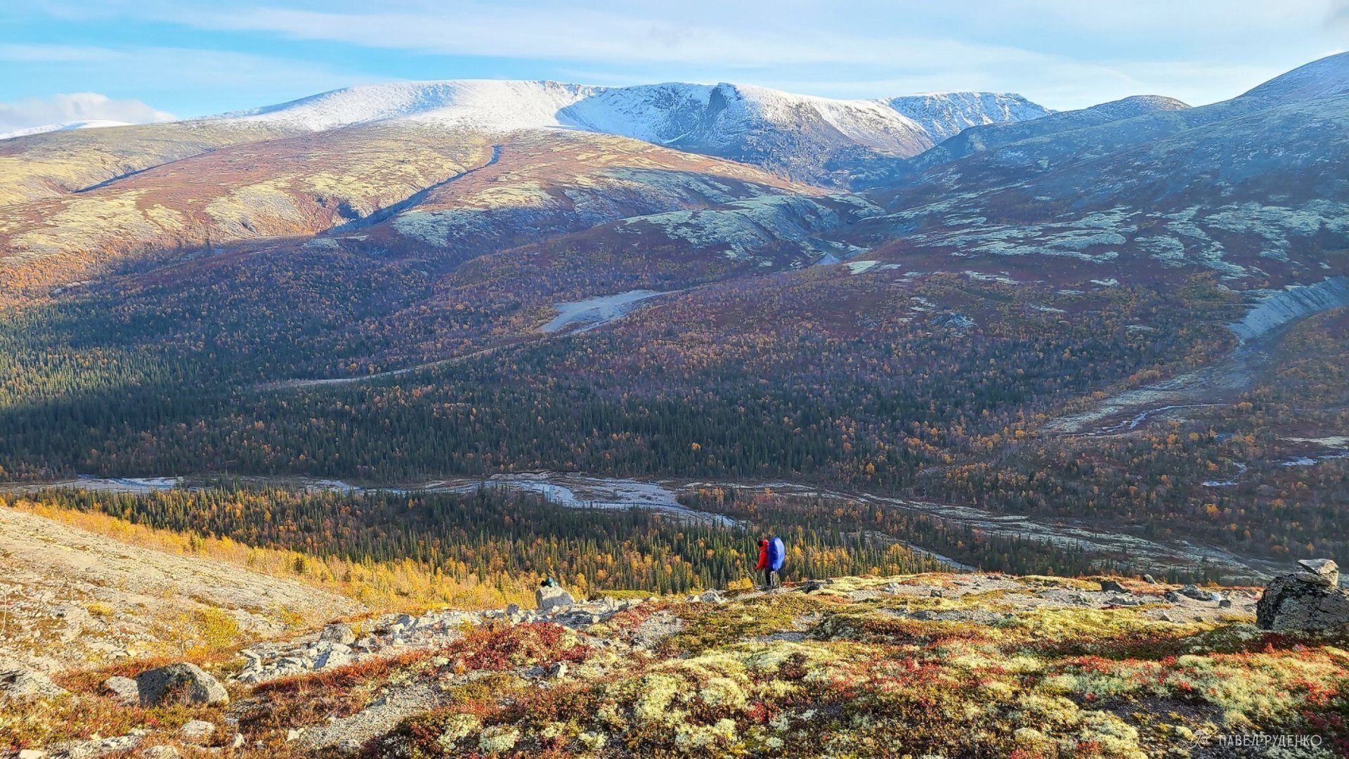
View of the Lapar Ridge Pass, Khibiny, autumn, September 22.
Why you should go to the Khibiny
I can walk around the north endlessly, it's too good with its spaciousness, atmosphere, views, and nature. Khibiny is the most popular tourist destination on the Kola Peninsula and the largest mountain range. Nearby there is the Lovozero Tundras tourist area and the less known Monchetundra ridge.
In the center of the Khibiny massif, there is the base of the emergency rescue service of the Ministry of Emergency Situations (ERS), it is 18 km along the dirt road from Kirovsk. This aspect is a good help in terms of improving the level of safety and logistics. You can get to the center of the mountains in summer and winter, as well as evacuate quickly. Near the ERS, there is the Kuels'porr tourist base with a hotel and a bath. It operates in winter from the end of December to the beginning of April, in summer from July to mid-September, in the off-season it is closed because the road is impassable.
The highest point, Mount Yudychvumchorr, is 1,200 meters. It would seem that this is not much compared to the heights of the Caucasus. And I've been to the Himalayas, where eight-thousanders rise around. But due to the northern location, the low mountains retain their power, beauty, and severity. Advantages: no altitude sickness, no затяжные подъемы и спуски, which means less fatigue and knee strain. At the same time, there are enough gorges and passes to come back here and walk along completely different paths.

View from the tent to Lake Imandra, on the hill near Aku-Aku, Khibiny, summer, August 18.
Compactness. Due to compactness, we have many route options from 2 days to 2 weeks autonomously. At the same time, safety increases. In case of an emergency, it's not far to go to civilization.
Beauty. Even at such altitudes, there can be snow at the top, and 500 meters of difference completely change the nature from lush forests to bare tundra and scree. In summer, there is polar day, and from the end of August, you can see the northern lights.
Freedom. No заповедные zones, permits, etc. Freedom of the north, walk where you please, pitch a tent where you want.
Good Logistics. You can get to the Khibiny cheaply and quickly. There is an airport and a railway station nearby “Apatity-1”, and the entrance to the mountains starts right from Kirovsk. No заброски needed here.
No ticks. Due to the northern location, there are absolutely no ticks, snakes, scorpions, dangerous spiders. There are few insects in general, so you can lie on the grass and not worry.
More northern beauty I have on Instagram, come and follow!!!)
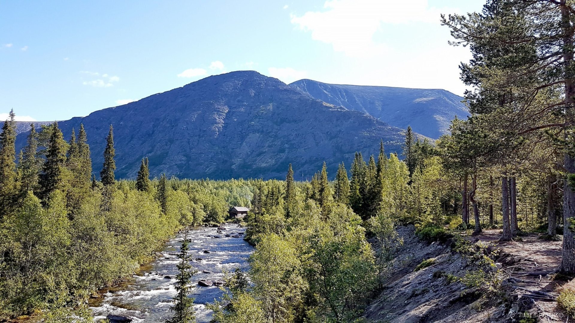
River Kuniyok, center of Khibiny, view of the ERS base, summer, August 15.
Relief and features of the Khibiny
The mountain range has a compact scale of 40 by 40 km, but a large number of passes and gorges. This allows you to build a huge number of diverse routes in winter and summer. For example, in similarly sized Lovozero Tundras, there are fewer route options. On my summer trek, the Ministry of Emergency Situations said that there were 700 registered tourists in the area. Among them, a girl was going solo, like me, the Ministry of Emergency Situations smiled and wished her luck to meet her)) At the same time, I met only 2 small groups in a week, although I was on a popular route. There are few people here, you don't push on the trail, you don't have difficulties with setting up camp.
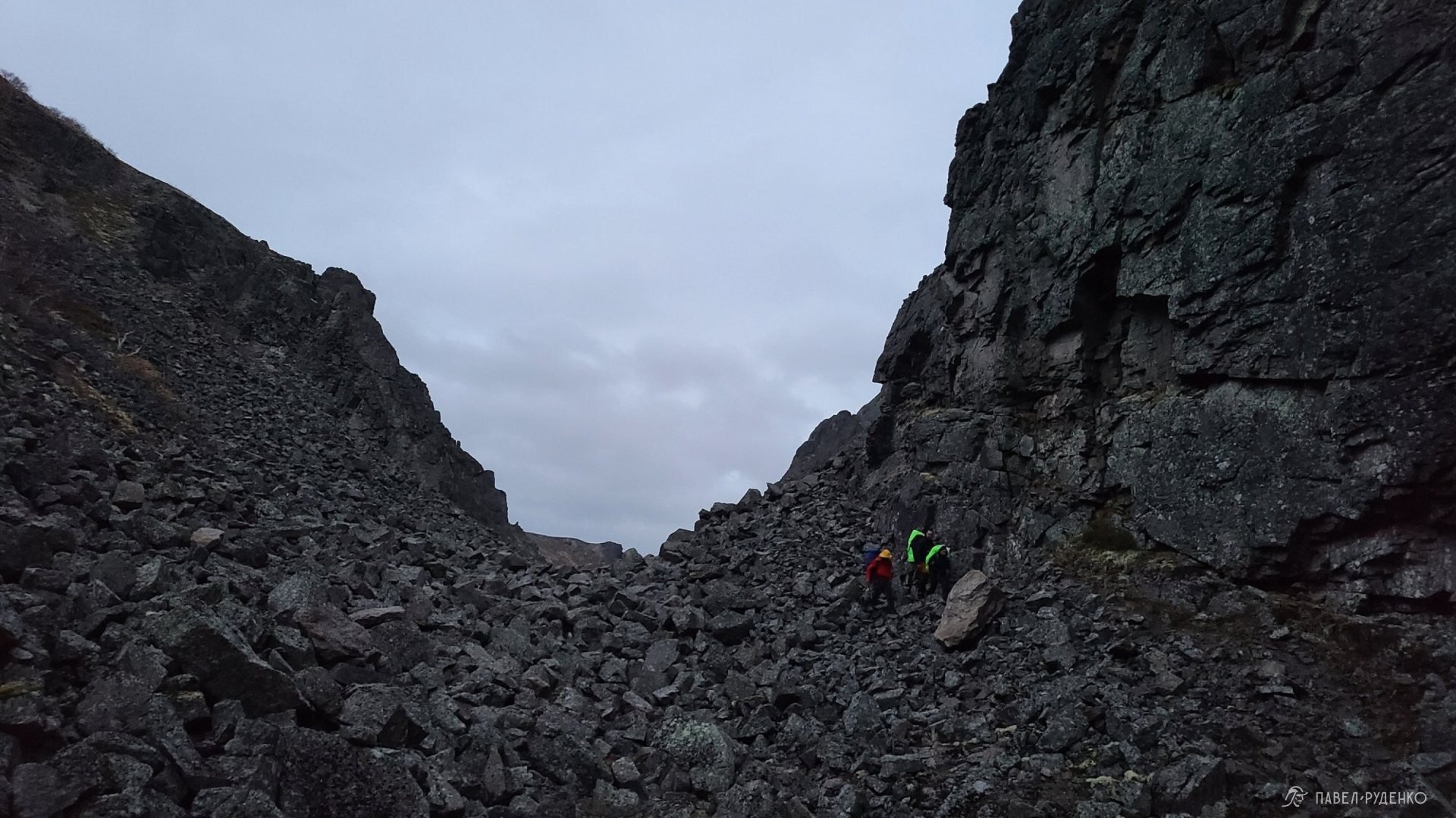
The mountains often have peak-shaped summits, but there are also plateau-shaped ones. Most passes have a highest point of 900-1,000 meters, i.e. 100-200 meters lower than the peaks. The passes have different difficulty categories, from н/к (uncategorized) to 2a. The passes have scree of different sizes, the larger the scree, the more difficult and dangerous it is to move. Some stones are alive, you need to be vigilant and careful on the passes. The stones themselves are quite rough and you slide less than in the Caucasus and Zailiyskiy Alatau in Kazakhstan.
Streams form from snowfields and alpine lakes, which turn into rivers in the gorges. Rivers are crossed either by wading or through improvised bridges. Trails exist in all popular directions, so movement is fast and convenient.
Northern part of the Aku-Aku Gorge, Khibiny, September 26.
Sign up for the best treks in the Kola North:
Maps, route
Below you will see two tracks with maps for different routes. To download GPS for Garmin or KML for Maps.me, you need to click on the 3 dots to the right of the track name and "save as GPX" or "save as KML" and add it to your app. To download paper maps, click on the button below.
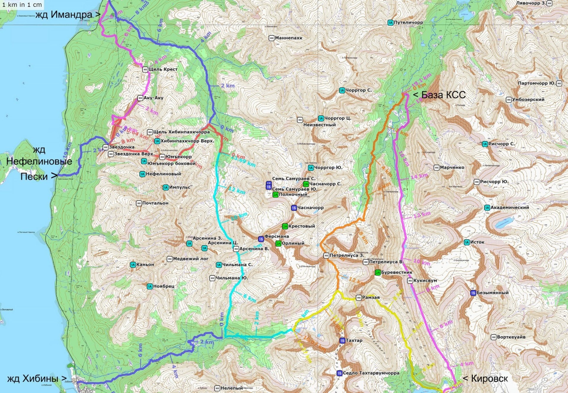
Main 5 days, 71 km, emergency exits.

Main 7 days, 55 km, emergency exits.
Weather. Best season for trekking
The season in the Khibiny is from mid-July to the end of September. The Ministry of Emergency Situations said that there was so much snow that in June they traveled by snowmobile from the base to Kirovsk. Of course, this is an exception, but you need to understand that this can happen. Naturally, in June and July, the snow melts, the water rises, and it's more difficult to move around the area at this time. The rivers are full of water, and the trails are partially in the water. In late September, the weather can deteriorate significantly, the night temperature is around 0C, snow on the passes, strong wind. But sometimes the weather is good and warm, here it's impossible to predict, you just need to be prepared for clothing and gear.
The most comfortable time is from August 1 to September 10, lush greenery, the warmest time of the year, birds singing, beauty.
Around September 10, autumn begins, the vegetation changes color, and there are rich red and yellow colors. Many people come here in September because autumn is especially beautiful here and there is a chance to see the northern lights.
The Khibiny are located beyond the Arctic Circle, and the Kola Peninsula is blown by all the winds. Be prepared for possible gusty winds on the peaks and passes, precipitation and clouds on the passes, which make visibility minimal.
Having a navigator or compass and maps that you can use well is a must. In severe weather and poor visibility, it's better not to move across the plateau but to pass through несложные passes.
Warm and windproof clothing is a must even in summer, occasionally the temperature can drop to 0C.
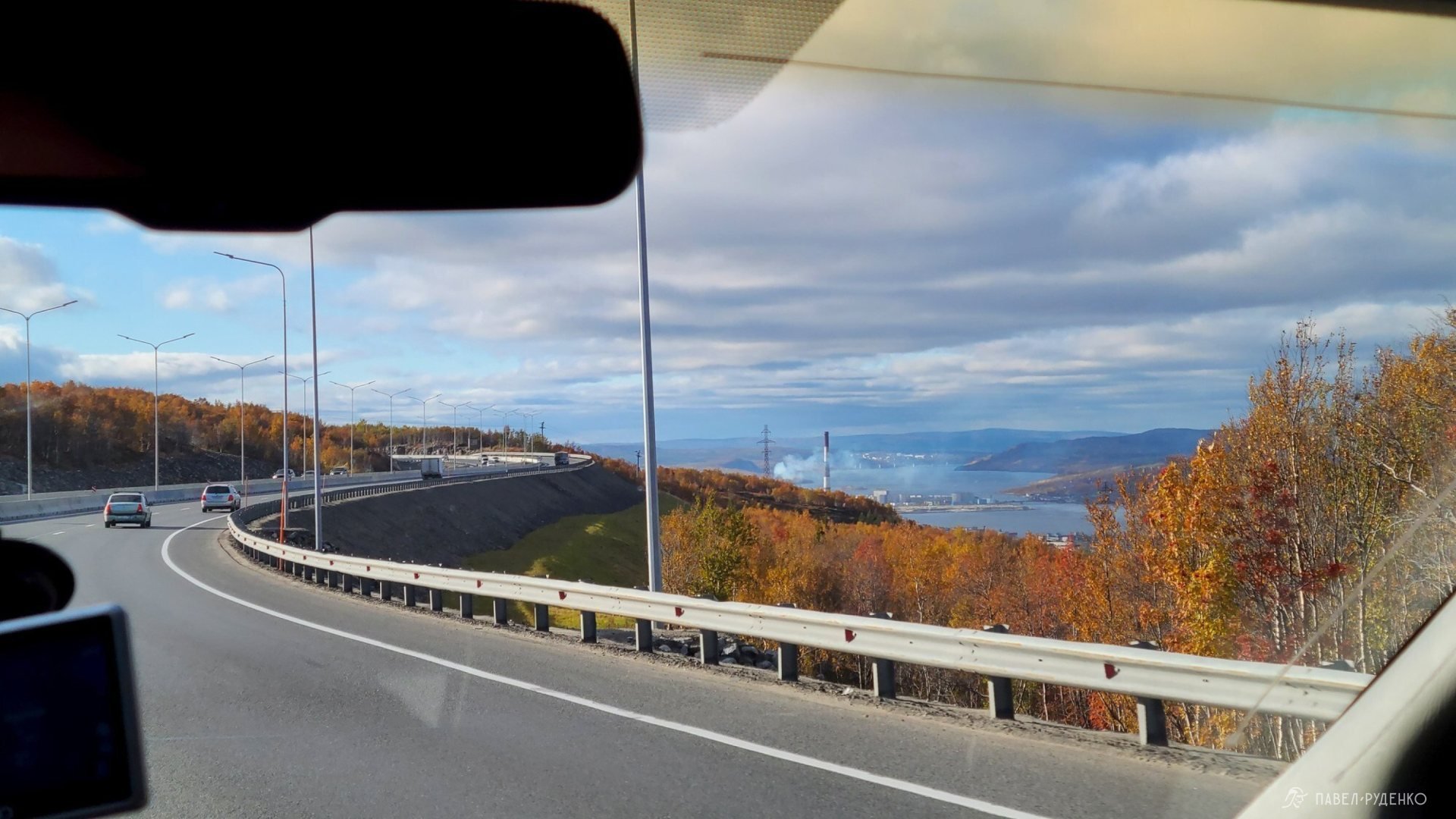
Transport, how to get to the Khibiny
You can start a tourist route from the city of Kirovsk (near the polar botanical garden), Imandra railway station, Nefeline Sands railway station, Revda village. The route can be сквозной, radial, circular.
You can get to Kirovsk in three ways:
- By plane to Kirovsk Airport. To Murmansk Airport, but with a transfer to Kirovsk or by train to Apatity-1, it's cheaper on it.
- By train, for example, from Moscow to Apatity-1 railway station. The most comfortable is Arctica. From the station, a taxi is about 600 rubles or by direct bus No. 131 or others, but with a transfer in the center of Apatity.
- By car
- Hitchhiking. From Murmansk to Kirovsk, I got there in 5 hours on 4 cars. The drivers are responsive, but the traffic on the highway is not very high.
Communication on the route
In the Khibiny, as in the Kola, Megafon and MTS work best, the coverage of other operators is very poor. If you use such a SIM card, you can buy it in the city and replace it for the duration of the trek. The connection will work a little earlier, at the exit from the mountains.
See the coverage area below by the link:

Gas and fire
Gas can be bought in Murmansk, 100 meters from the railway station in fishing stores, Kominterna St. 18, 20, 22. Or in other stores in Murmansk. In Apatity, at Sport Master or fishing stores. Buy in advance if you are traveling by train, carrying is allowed. I've done this many times, it's reassuring to know that everything is already packed. The travel time is one and a half days, enough to get some sleep and rest after a busy week. The atmosphere is cool, especially comfortable on the Arctic train.
Gasoline is sold in most hardware and construction stores.\n
Fires can be lit in the Khibiny, but keep in mind that not all campsites may be in a forested area or simply there may be no firewood at the most popular campsites.\n
There is no firewood near the KSS base in the central part of the Khibiny. All passing groups stop here. There is little firewood at the confluence of the Goltsovka and Chasnayok rivers, but it increases moving north towards the Mannepakhk river. Also, it cannot be found in the Aku-Aku gorge, especially near the Emerald Lake. Only in the southern part, in the "asterisk" overnight areas, firewood can be found.
In my hikes, I rely only on gas or gasoline, it's faster, more convenient, less time-consuming and effort-consuming. Of course, the choice of fuel depends on the group, the style of the hike, and preferences.
\n\n\n\n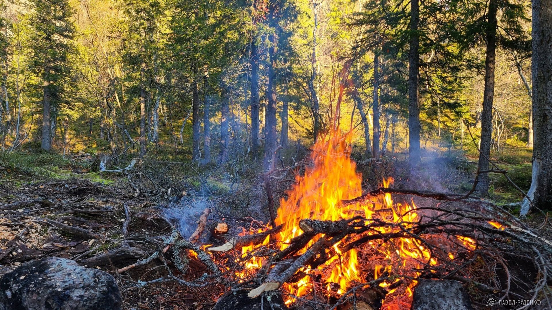
Water
Water in the Khibiny is quite good, there are streams, rivers, and lakes everywhere, the water is clean. There's more in spring, less in autumn, I don't see any particular features. I usually carry a filter, just for convenience and precaution. Model Catadyn BeFree.
Danger
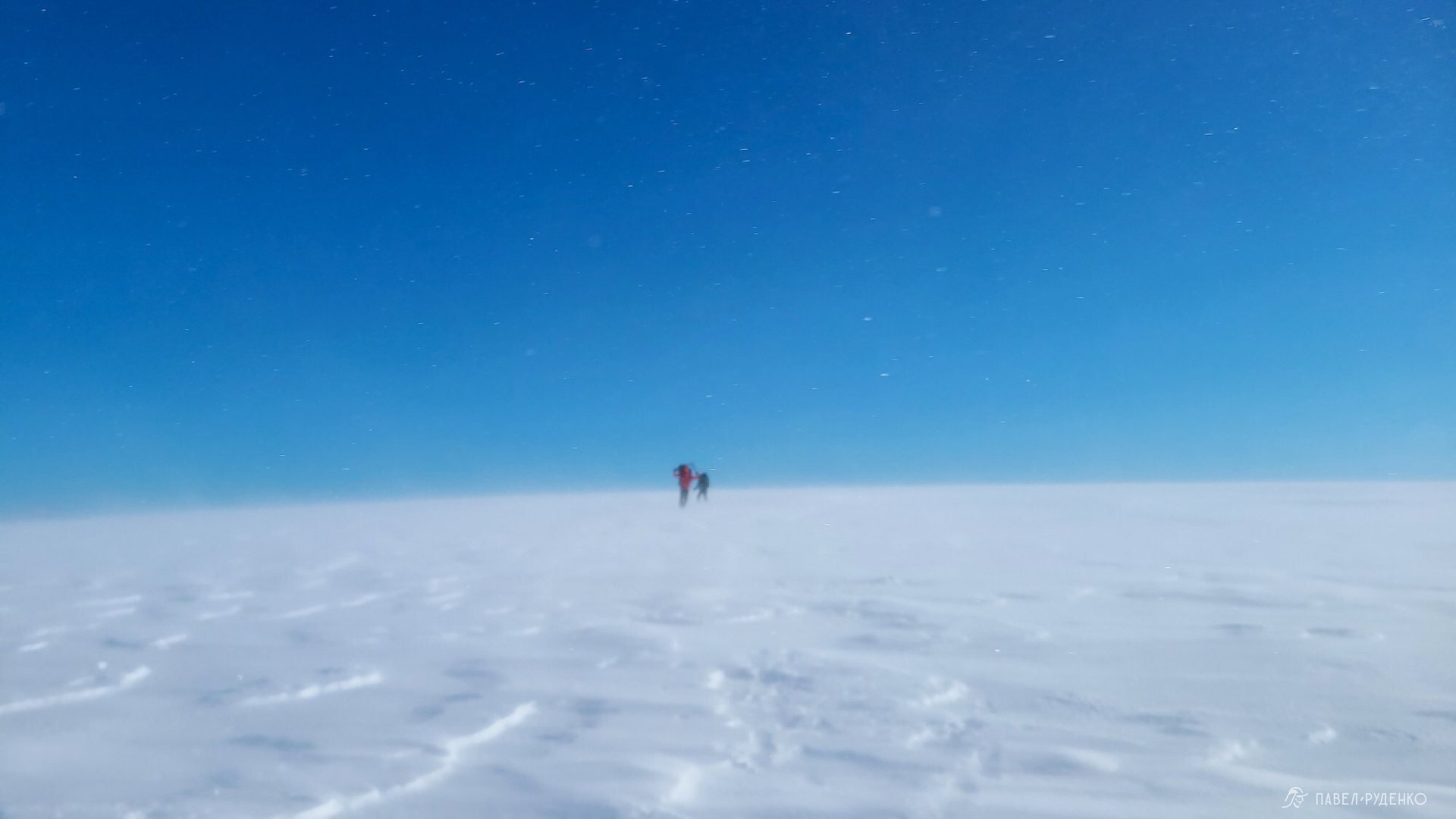
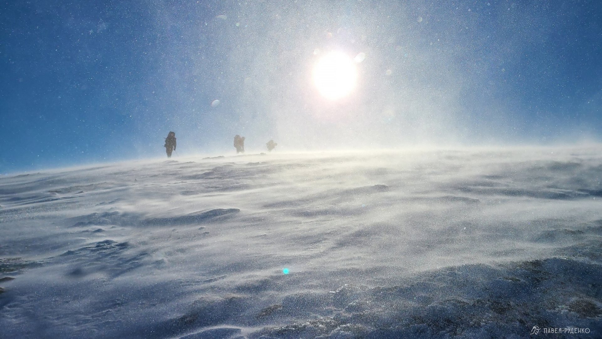
Live rocks. All passes are littered with rocks of different sizes, the slope angle varies, so when going over a pass, there's a chance of stepping on a movable rock and twisting/breaking your leg. This happens, after all, the extra weight of the backpack and the complexity of the terrain lead to injuries. The Emergencies Ministry reported several recent cases where hikers broke their legs on the descent from the pass and had to be carried down on stretchers. This is not specific to the Khibiny, it applies to all mountains. When moving in a group, you need to be extra careful so that rocks don't fly down on those below. You need to move close to each other and when a rock breaks loose, shout "ROCK" to your comrades. The danger of triggering a rockslide is only on some passes with a steep slope, there aren't many of them.
\nPoor visibility, cloudiness. The weather in the Khibiny changes quickly, there's a lot of precipitation, frequent cloudiness. Because of this, visibility on the passes can be poor, down to 5 meters and then it's milk. It's only possible to move by GPS or with very skilled use of a compass and map. In such conditions, it's impossible to find the pass. Therefore, prepare your navigation. I've been using the Garmin eTrex 20x for 8 years and a smartphone with a recorded track. After the last hike in September, I started thinking about replacing it with a more powerful model, after all, the speed of the 20x is not high, and in difficult weather conditions, seconds matter.
Wind. The clouds here are low, which is why you can see how fast they are flying, especially when you walk through the gorge and look up. The wind speed on the peaks sometimes reaches 50 m/s. More often it's around 15-20 m/s.\n
Snowfields. On ascents and descents, you will encounter snowfields, they greatly simplify the descent and ascent, after all, walking on smooth snow is easier than jumping on scree. The danger lies in the fact that you can slip and roll down the snowfield, and there may be a cliff or rocks below. You can also fall through the snowfield and injure your leg, as the snow melts and voids and streams form under the snow.\n
Weather variability. In July, August, and September, the temperature can drop below 0C and snow can fall, despite the fact that the previous days were +15 to +20 and sunny. Tragedies have occurred here because of this. With a sudden change in temperature, in difficult weather conditions, it's easy to make mistakes that lead to the most unfortunate consequences. Therefore, take the necessary amount of warm clothes, a warm sleeping bag, and reliable gear, be guided by experience and common sense.
You can read about emergency cases on the website:
\n\n\n
Registration with the Emergencies Ministry
A convenient form for filling out the questionnaire, enter your data, route, contacts of relatives.\n
You need to call the Emergencies Ministry before starting the route and at its end. The Emergencies Ministry will call every day. My connection didn't always work, so I would get 2 messages about missed calls in the morning and afternoon, and I would call back when possible to report that everything was fine.\n
The Emergencies Ministry in Murmansk: 8(8152) 39-99-99\n
Link to register a hike with the Emergencies Ministry:
Academic Pass 1a, descent to Rischorr South, 1040m, Khibiny, September 23.
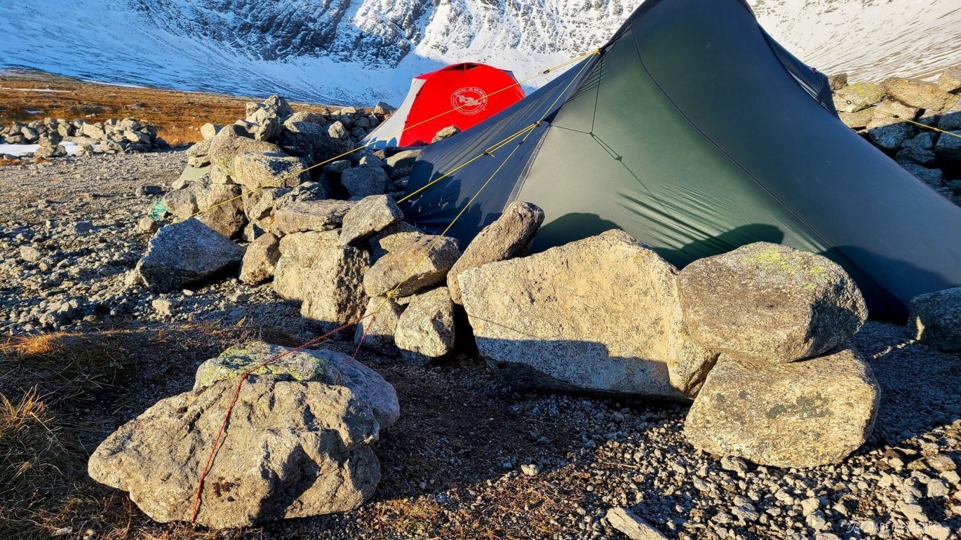
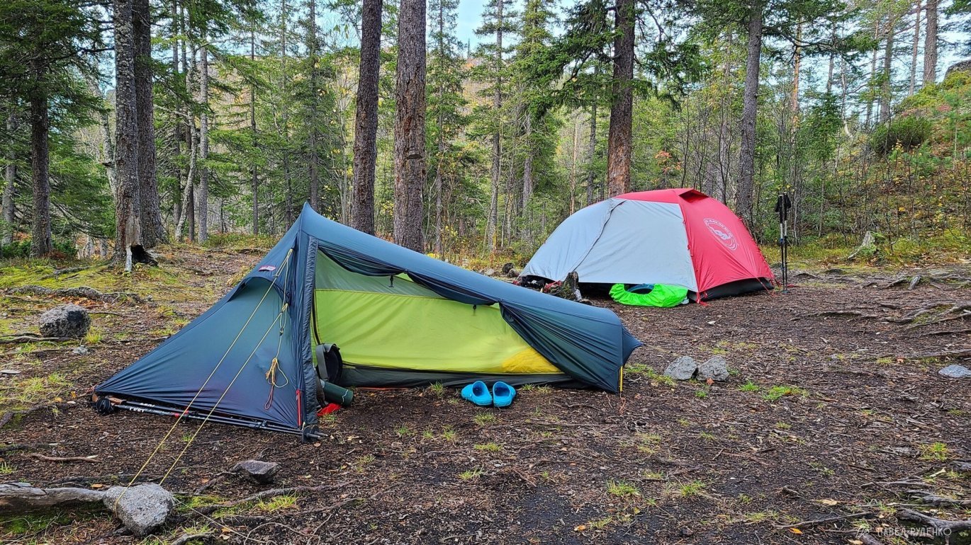
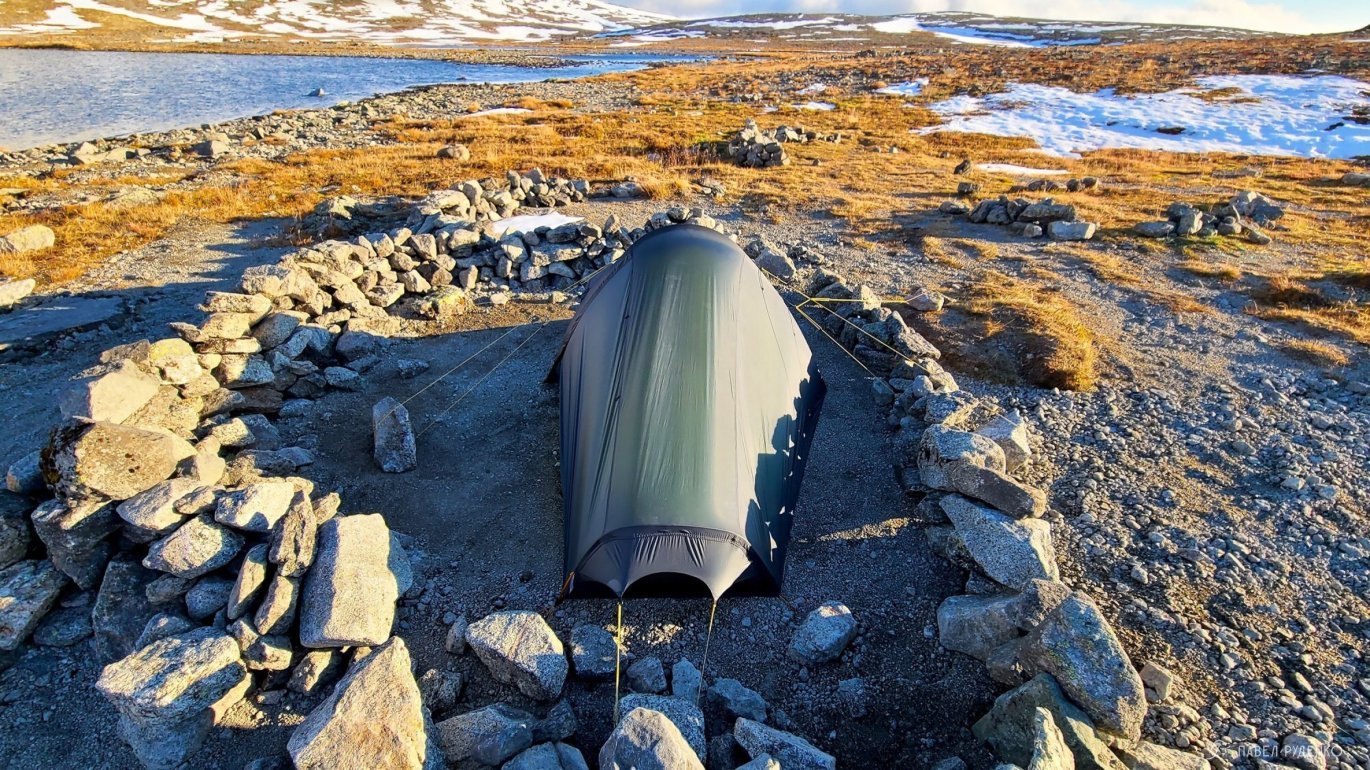
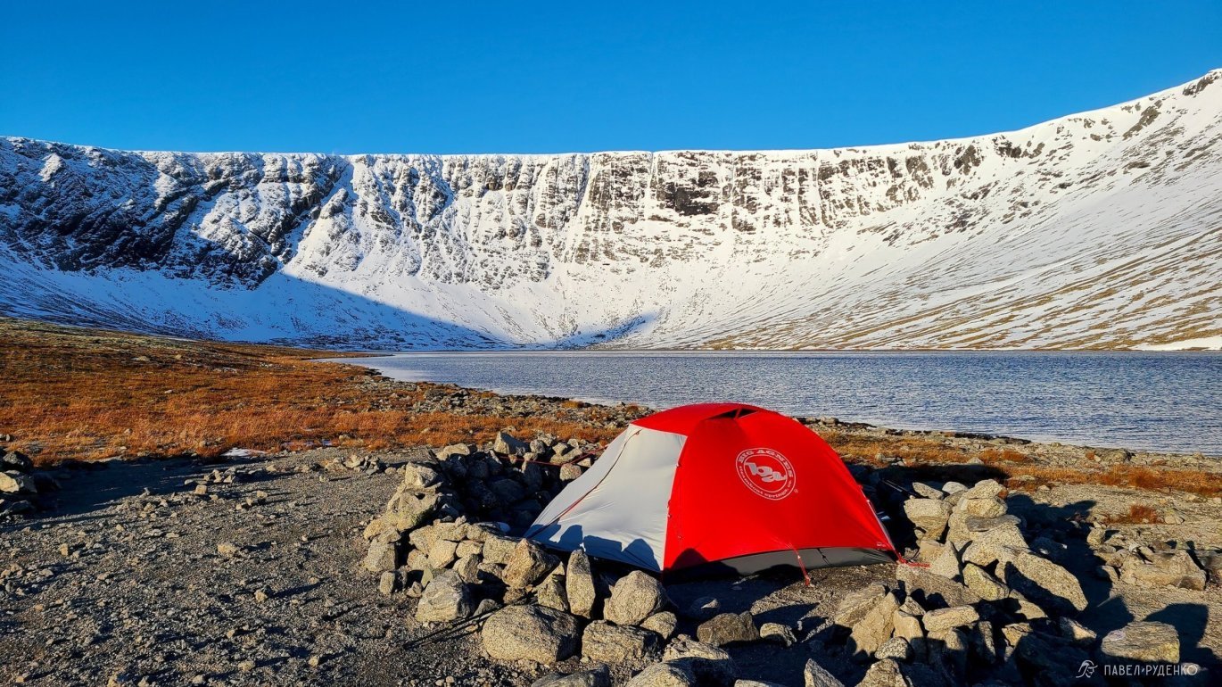
Features of camping in a tent
There are no problems with finding places for a tent in the Khibiny. In most places where you want to stop, you can find a flat area on a soft bed of moss or just rocks.\/p>
For the most part, there's no need to prepare a new place for the tent, as the main campsites are well trodden. In a solo hike, I stopped twice outside the prepared campsites, once after terrible bad weather, I was just tired and frozen, the second time because of the beautiful view from the hill. The water is far away there and no one puts up tents, but for me it's not a problem, I took 3 liters of water with me, that's enough for dinner and breakfast.\n
Open campsites that are blown by the wind are sometimes blocked by rocks. Keep in mind that the lower you descend from the pass, the warmer and less windy it gets. After all, the forest is a natural protection.\n


View other articles on the Khibiny:


