
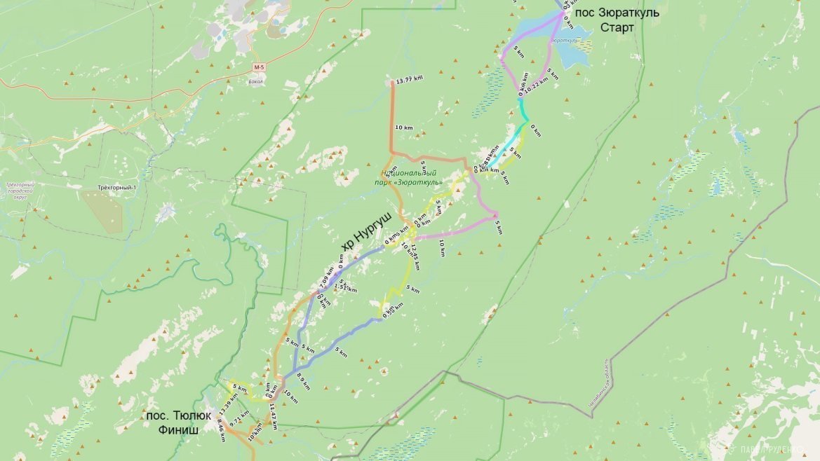
Route idea
In January, I planned to go on a week-long solo hike. In my favorite north, the daylight hours are still too short at this time, so I looked at other regions with simple logistics and a relatively safe route. The Southern Urals fit all the parameters, it remained to choose a specific place. I wrote to my friends and one of the main popularizers of the Urals, Oleg Chegodaev, and got three options:
- Tyulyuk - Zigalga - Bakty - Iremel - Tyulyuk
- Taganay National Park
- Zyuratkul - Nurгуш Ridge - Tyulyuk
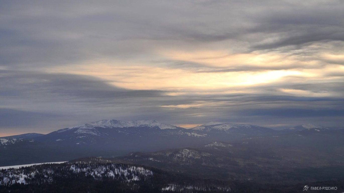
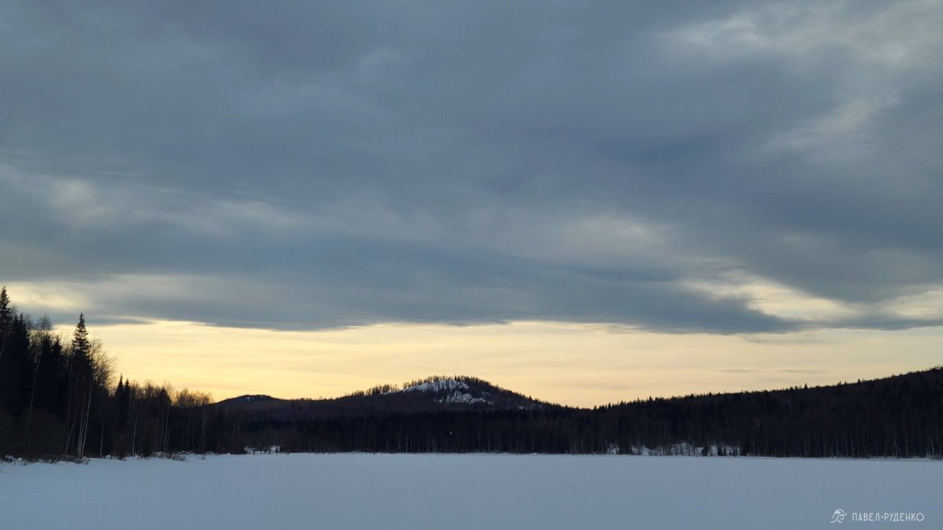
I liked the Zyuratkul - Nurгуш Ridge - Tyulyuk route the most. It's not as crowded as Taganay, and you can hike along the ridge, above the forest zone, which means less snowshoeing, while enjoying the views)) I set off there, but during the trip, I had to adjust the route and return to Zyuratkul after the Nurгуш Ridge, which I will talk about later.


Route preparation
The route goes through the Zyuratkul National Park, which does not entail any special restrictions for tourists. Entrance is free, movement throughout the national park is free, there are route markings and signs in some places.
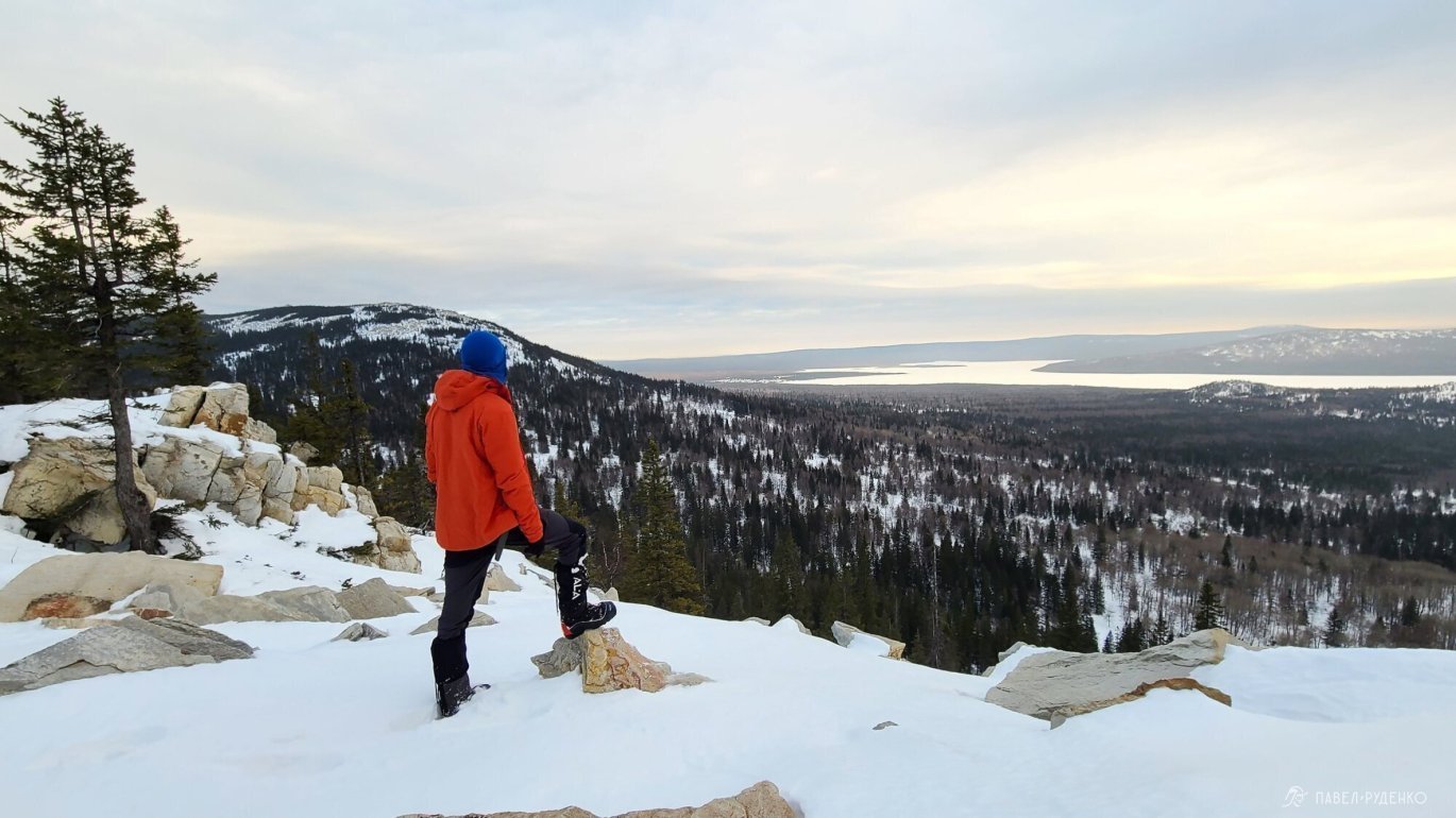
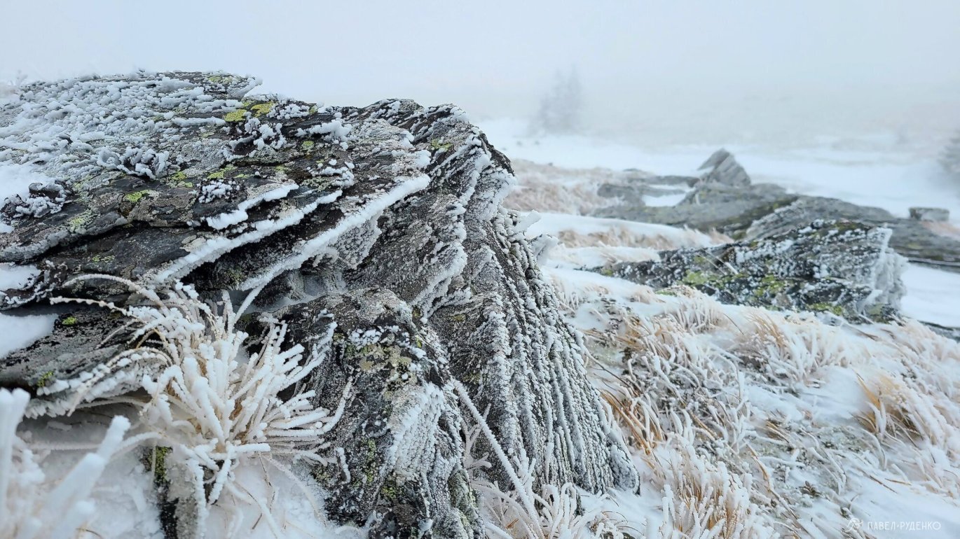
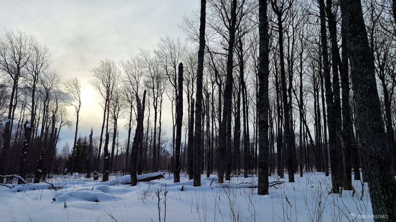
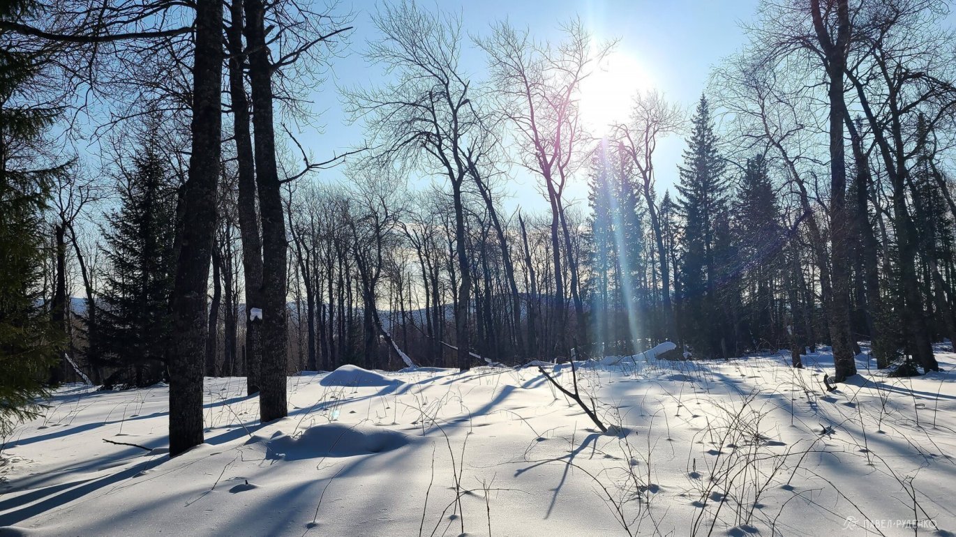
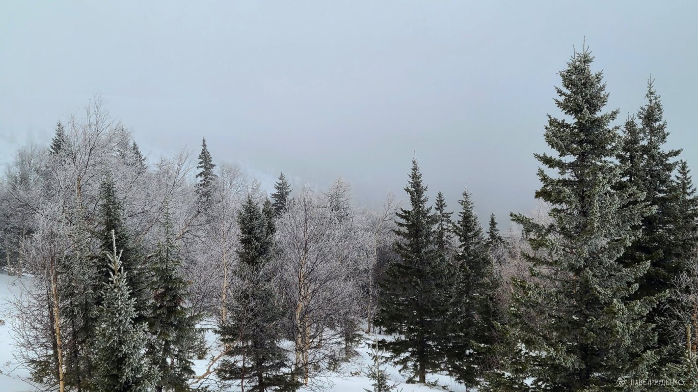
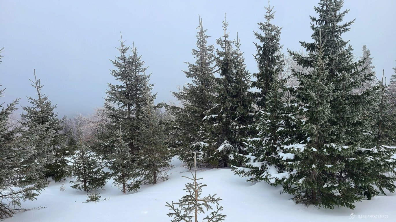
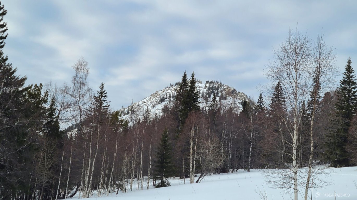
The highest point on the route is Big Nurгуш, 1406m, which is also the highest mountain in the Chelyabinsk region. The forest zone usually ends at an altitude of about 1,100m, then there is scree or soil, which turns into windy crust in winter.
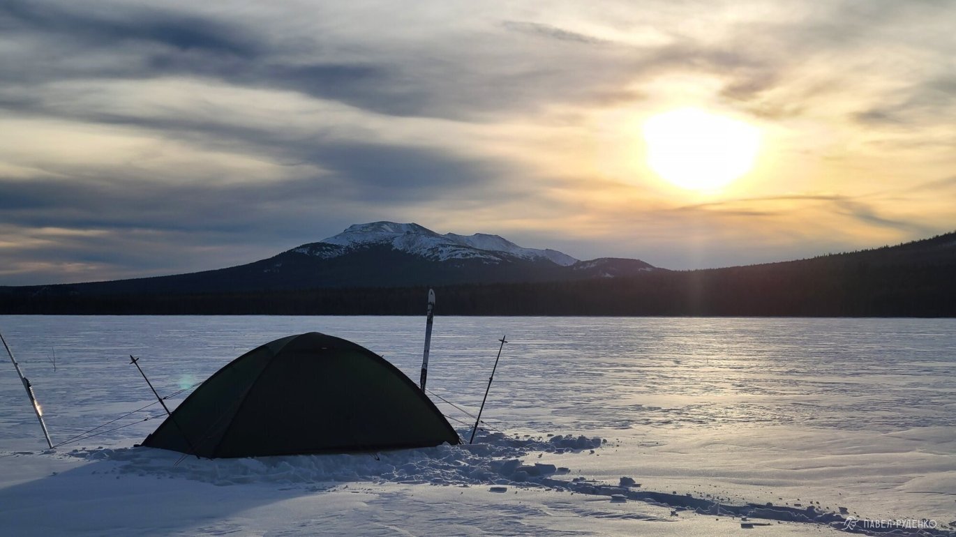
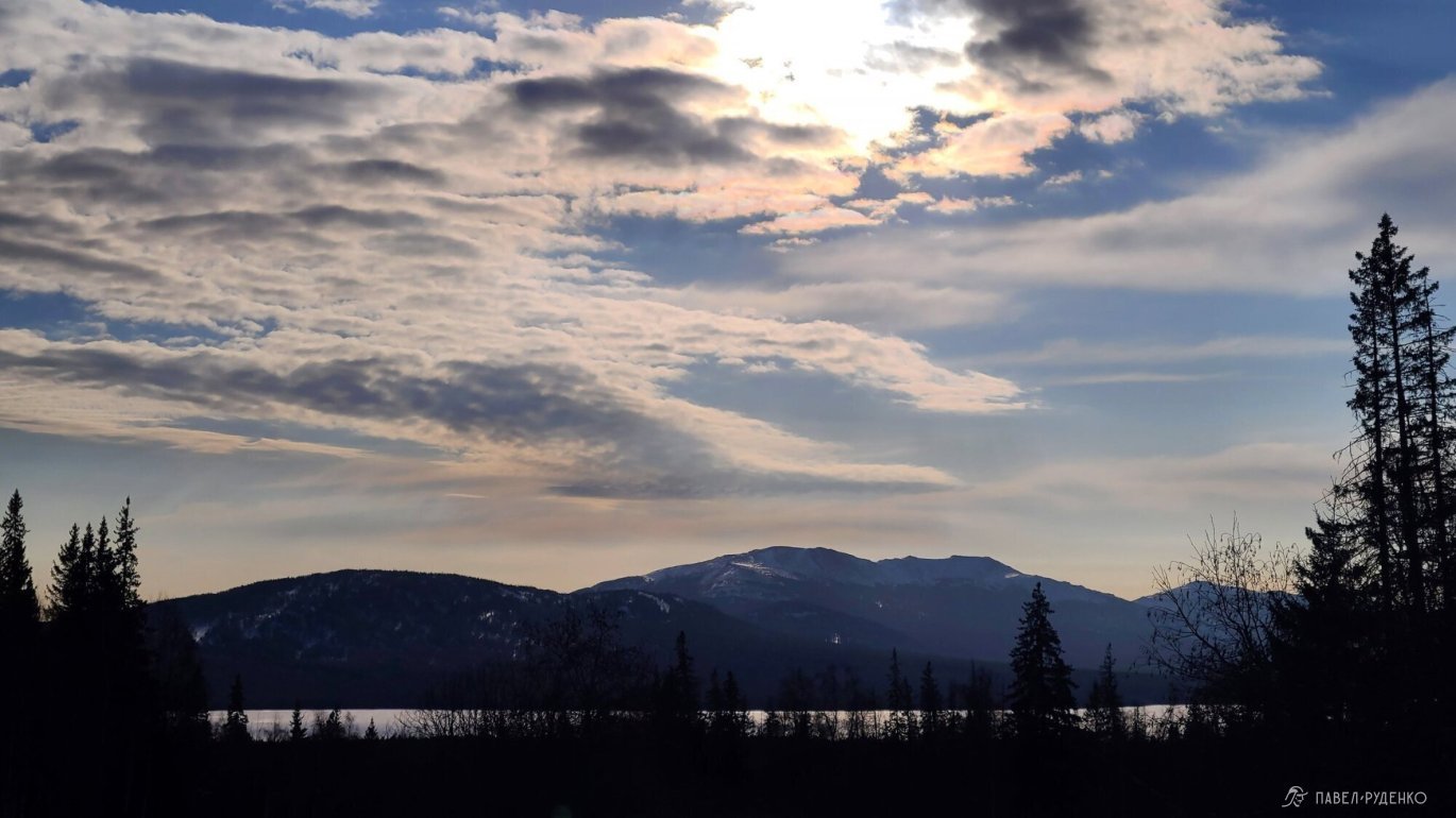
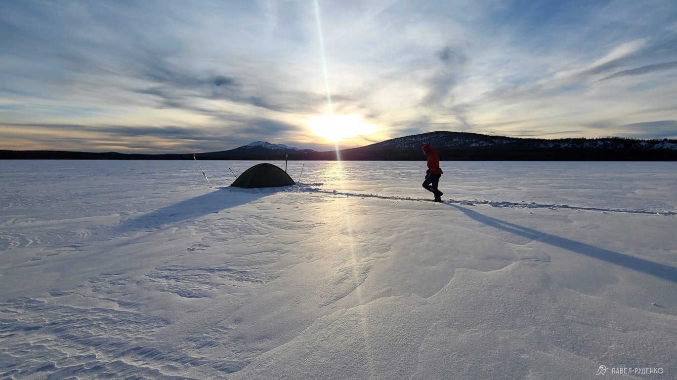
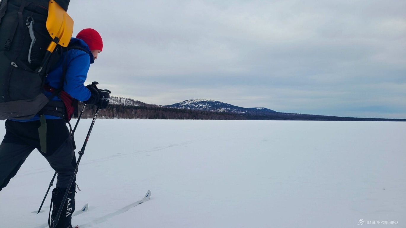
Start from the village of Zyuratkul at an altitude of 724m, where the largest high-mountain lake in the Urals - Zyuratkul - is located. The maximum depth is 12m, the length of the coastline is 29km, it is used for water supply of the city of Satka. The ice is reliable, the national park provides the following information:
“Zyuratkul belongs to the type of lakes with stable ice cover lasting 6–7 months. The establishment of the ice cover is observed on average on October 24. The beginning of the destruction of the ice cover, that is, the appearance of ice edges, is observed in the first half of April. The average duration of the ice cover on the lake is 202 days, the period free of ice is 160 days. The maximum ice thickness was observed at 133 cm.”
This information was confirmed by local fishermen, of course, you should be careful in the estuaries of rivers.


Weather
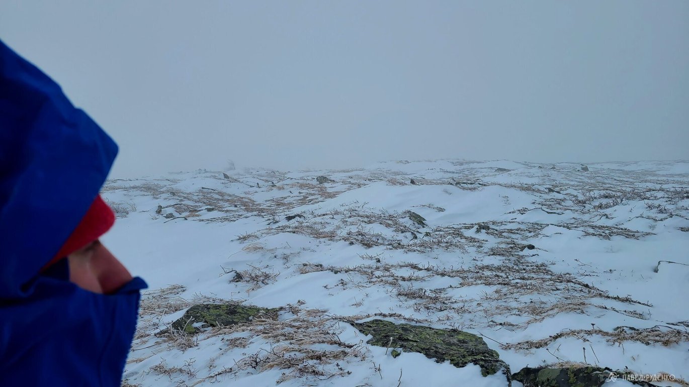
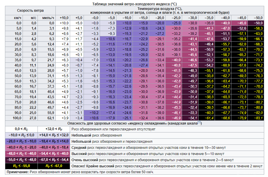
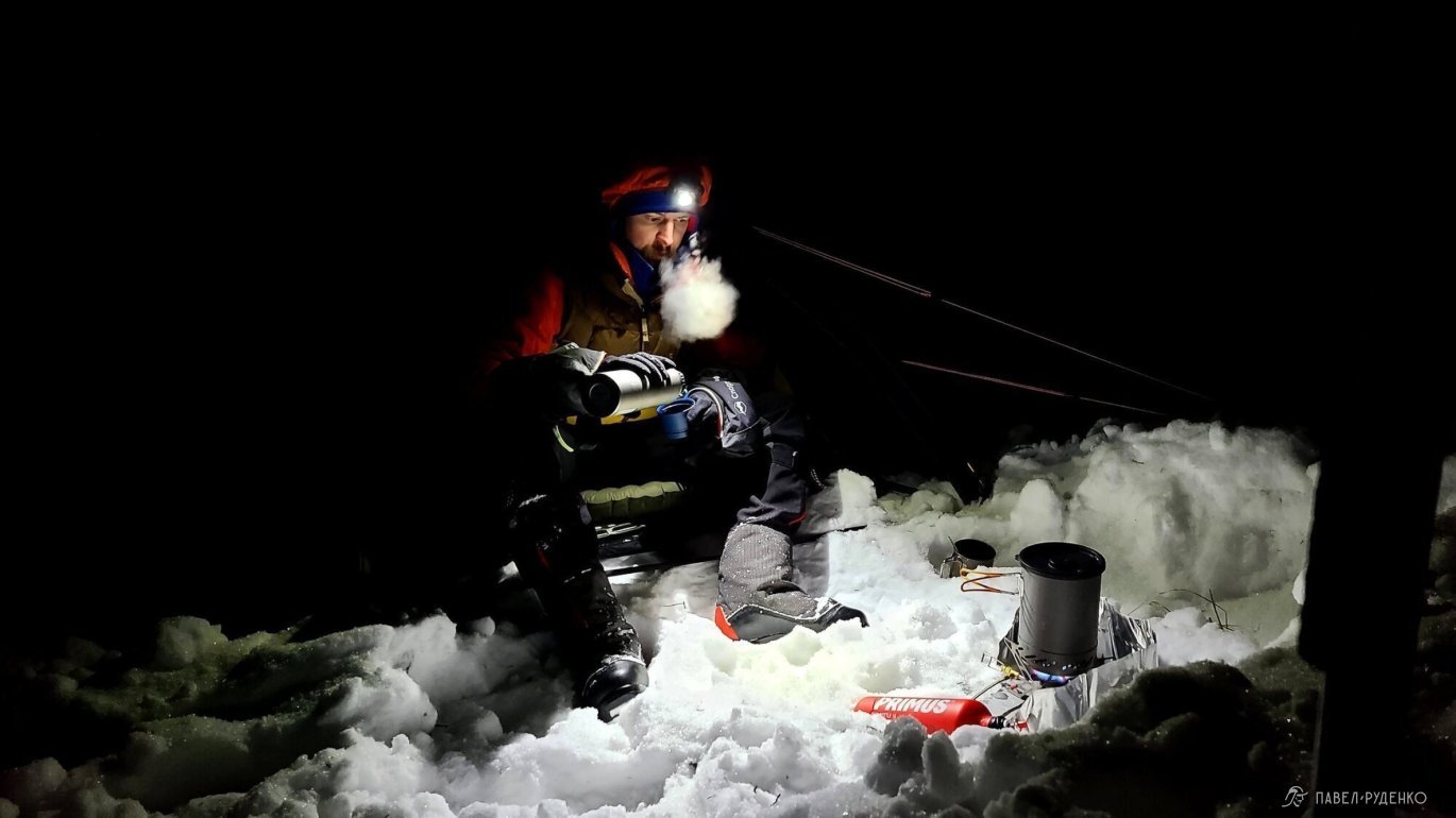
The Urals are famous for their wind, and this must be taken into account when preparing. Before the dates of my hike, i.e. in mid-January, windy weather persisted, 16-20 m.s., if anything, above 20 m.s. is considered a storm. Daytime temperature -15C, feels like -30C, and so for 10 days.
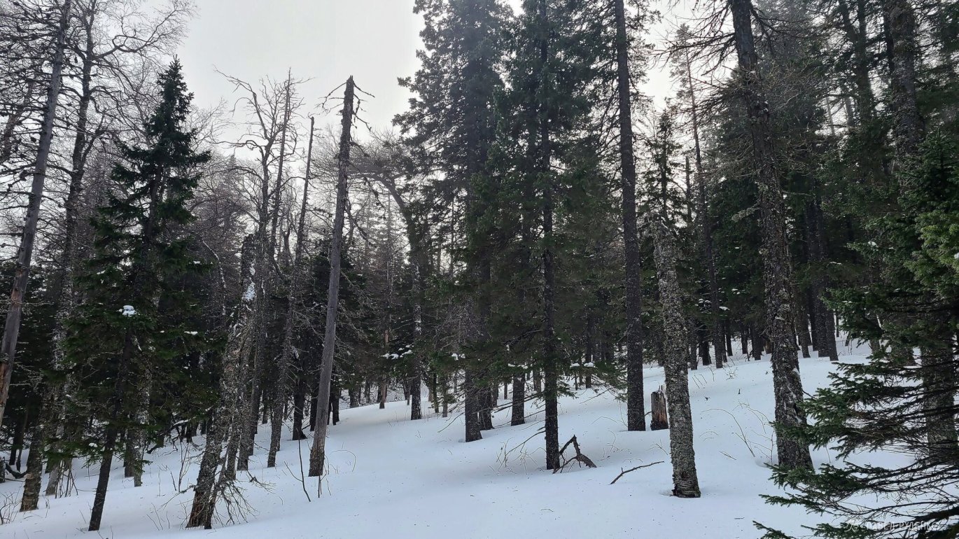
Naturally, you can encounter the full severity of the wind at the top, it's noticeably more comfortable in the forest zone. Therefore, it's better to set up camp in the forest zone.
Gismeteo has a weather diary for Tyulyuk village 550m. I looked at the forecast in January since 2015:
- Daytime temperature ranges from 0C to -18C, average around -10C.
- Night temperature ranges from -3C to -25C, average around -15C. Usually cloudy.
- At the top, it's on average 5-10 degrees colder, plus the wind-chill index of the temperature feeling.
There's a lot of snow here, snowshoeing in the forest zone was 30-40 cm. At the same time, grass is visible in places at the top. The wind here is often and strong enough to blow down to the ground. According to trail markers on openstreetmap, snowmobile tracks passed. Some are covered with snow, barely visible in places with snowshoeing 0-20 cm, which made movement much easier where they were.
On the Zyuratkul National Park website, we are given the following snow data:
“A stable snow cover is usually formed in the third decade of October. The snow cover is very uneven. The height can reach 75–80 cm. The average date of destruction of the stable snow cover is April 20, the earliest is March 21, the latest is May 3. In May and even June, heavy snowfalls are possible.”

Transport
The start of my route is from the village of Zyuratkul, it is located between Ufa and Chelyabinsk. Therefore, you can get there from both cities, depending on the price of air tickets, etc.
From Ufa to Satka, you can get by train with a transfer, then by taxi to the village of Zyuratkul.
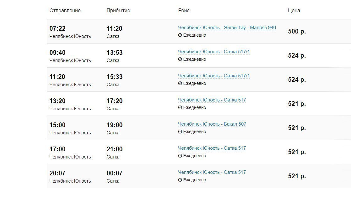
The option to Chelyabinsk seemed simpler to me. From the central bus station in Chelyabinsk, “Yunost”, bus No. 517 runs to the city of Satka, the nearest city to the village of Zyuratkul. Travel time is about 4 hours, the cost of a ticket is 500 rubles + luggage 300 rubles in 2021. I came across a large bus with a luggage compartment there and back, but it could also be a minibus. What kind of transport arrives will depend on the number of tickets purchased, the carrier adjusts to the situation. At peak times, in the morning and evening, there is a higher probability of a large bus; you can find out in advance by calling them. Other bus numbers also run in the right direction.
From the city of Satka, to the village of Zyuratkul, I took a taxi, the adequate price was 1,100 rubles in 2021. I took a taxi right at the bus station in Satka.
The distance between Chelyabinsk and the city of Satka is 190 km. The bus is on the road for 4 hours
The distance between the city of Satka and the village of Zyuratkul is 32 km. Half of the road is cleared by a grader, you can safely drive on a car. Taxi travel time is 50 minutes.


Registration with the Ministry of Emergency Situations
A convenient form for filling out the questionnaire, enter your data, route, contacts of relatives.
You need to call the Ministry of Emergency Situations before starting the route and at its end. The duty officer or operator of the Ministry of Emergency Situations will call every day, in the application I always indicate the number of the liaison who tracks the satellite tracker so that in places without communication, control is maintained.
- phone number of the Ministry of Emergency Situations in Chelyabinsk, general: 8 (351) 239-99-99
- phone number of the Ministry of Emergency Situations on the route, operator: 8 (351) 239-70-95
link to register the route with the Ministry of Emergency Situations: https://forms.mchs.gov.ru/registration_tourist_groups
Communication
Finally, I switched from Beeline to Megafon, lost in the cost of the tariff, but won in coverage. Megafon caught in the village of Zyuratkul and on the lake 4G, then the connection disappeared in the forest and appeared at the top of the Nurгуш Ridge. I prepared links to check the coverage of your operator.
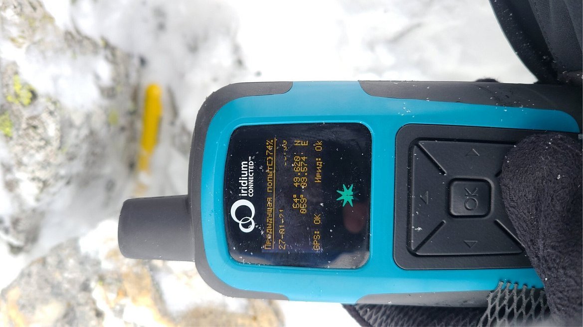
I also used the Iridium RockStar 360 tracker, took a tariff for 300 points for 2,950 rubles. I maintained contact daily, received the weather forecast, and transmitted my coordinates every 30 minutes.
Dangers
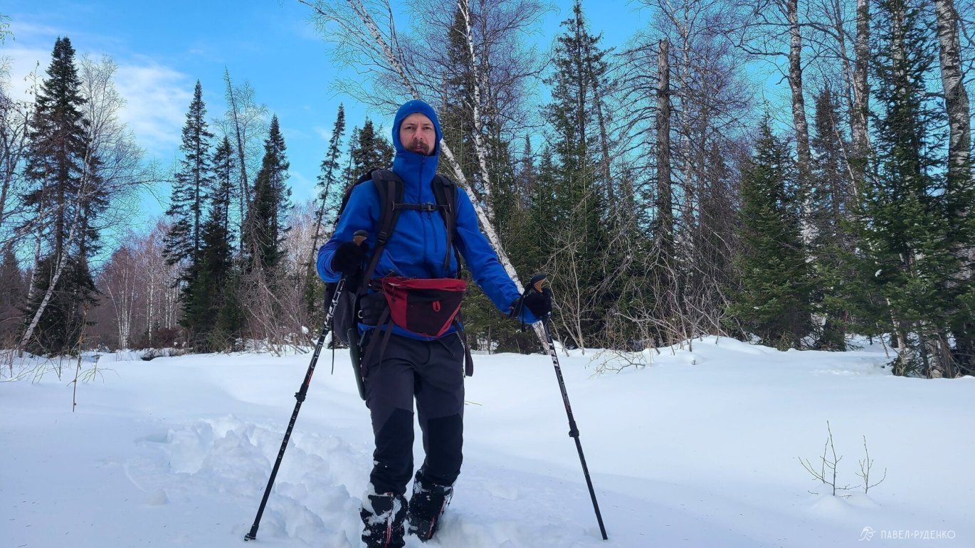
Weather conditions, cold, frostbite. The temperature in winter is less predictable than in summer, depending on humidity and wind speed, the feeling of cold can vary significantly. I take clothes and gear with a margin, this means that the mat, sleeping bag and tent fully meet the possible temperatures and wind. A system of mittens and gloves is thought out, there are always several warm spare ones. Warm jacket, insulated overshoes and gaiters for the camp. A few spare items, in case of falling into the water. The gear list will be at the end of the article. Understanding where you are and where to go in zero visibility, using a navigator or compass with a map. I carefully plan the route with many emergency exit options, in the process I use maps.me more often, if the phone does not show or needs to be checked, then Garmin etrex 20x and paper maps.
Breakdowns. In the cold, equipment breaks down much more often, in my opinion, this begins to happen at temperatures below -25C. It is important to have a repair kit and tools for repair.
Terrain. On the Urals, first of all, it is scree. Large boulders covered with snow, movement in such places happens without skis, so it is easy to fall between the rocks and get stuck or injure your leg. I tried to build the route so as to bypass the areas with scree as much as possible.
The condition of the snow. Depending on the weather conditions, the speed of movement in winter can differ significantly. You can comfortably cover 20 km along a fresh snowmobile track. In the absence of a track, with deep tracking in solo or small groups, you may not be able to cover 5 km. This factor is always unpredictable and requires careful route planning and emergency exit routes.
Wolves. In Zyuratkul National Park there are wolf packs. Shooting is naturally prohibited, so you can come across their tracks. The Ministry of Emergency Situations and local residents reported that there were no cases of attacks, so I would recommend having a flare or noise cartridges of a hunter's signal, just in case.
Avalanches. The risk of avalanches in the Southern Urals is minimal. The terrain is predominantly forested, in treeless areas and on the tops there is a lot of large scree that holds snow masses and frequent winds that turn the snow into windslab. All these factors reduce the avalanche hazard, I did not see any dangerous areas on the route visually. Of course, this does not make the terrain completely safe, even a small avalanche can completely bury you, so it is always worth assessing the situation.


Thoughts on gear and food after the hike
Please note that I had a solo hike for 6 days in January. Under different circumstances, the arrangements may differ.
Camus. I took two camuses, short nylon and long mohair, to test and understand the features. The long camus was so good, it confidently held on steep climbs and even on windslab, while gliding well, so there was no need for a short one. At the moment, I have made the following conclusions:
- The short camus is good on несложном terrain where the movement along the plain prevails. It allows you to move forward fast enough, while not falling at every mistake.
- The long camus is good for medium and difficult terrain. It holds uncompromisingly, saves a lot of energy and eliminates floundering in the snow.
Important. The material of the camus greatly affects the speed of movement.
- 100% nylon. Cons, it significantly reduces the speed of movement, high energy costs. Pros, durable, works better at around 0 temperatures
- Mohair and Mix (70/30 mohair/nylon), about 30% less durable than nylon, slightly more icing at around 0 temperatures, very fast, smooth sliding, less energy consumption. My choice
You also need to consider what other team members are using. If everyone has a short mohair camus, and you have a long nylon camus, then on a straight line you can get ahead so much that it will be a lot, while moving faster and more confidently on climbs and freezing while waiting for the others. In another team hike, there was a situation when everyone was walking on a notch on the lake, and one participant had a short nylon camus and sometimes he was lagging behind a lot, as the energy costs for movement were different. Conclusion, it's good when all participants are in the same conditions.
Lunch. I took two sandwiches a day, for lunch with bacon and cheese, for dinner with sausage and cheese. It is worth giving up the sandwich for dinner because of the too heavy weight. Sandwiches for lunch go well at temperatures up to -15C. If the temperature is lower, then take a thermos for food and make a full lunch in the morning.
Maggi. Do not take Maggi, the pot is too greasy, lazy to wash it)) Better to transfer butter into plastic packaging.
Snow pegs. Be sure to use carabiners on snow pegs. I experimented with lightweightening and just tied the rope to the pegs and hooked them to the guy lines, the method turned out to be unviable, under load the rope twists, gets tangled, and it is long and difficult to untangle in the cold.
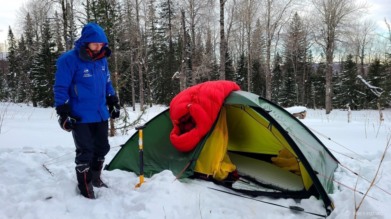
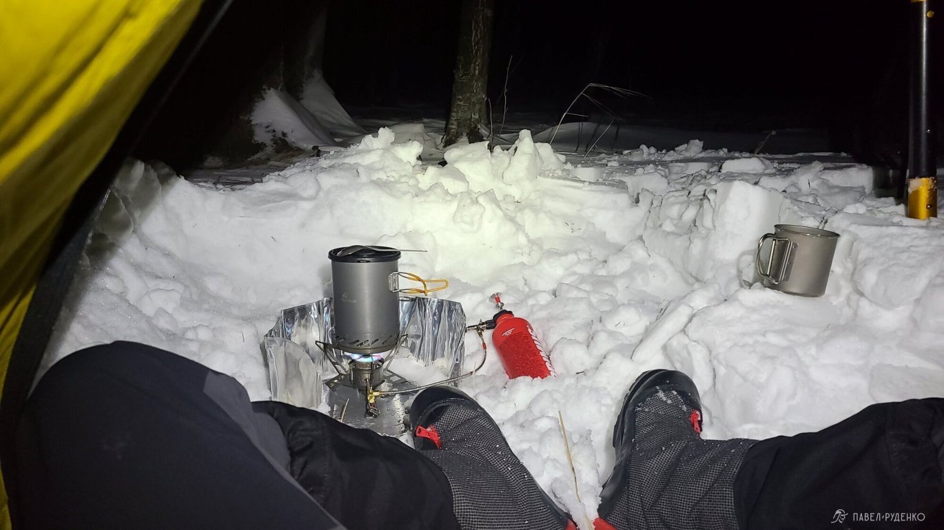
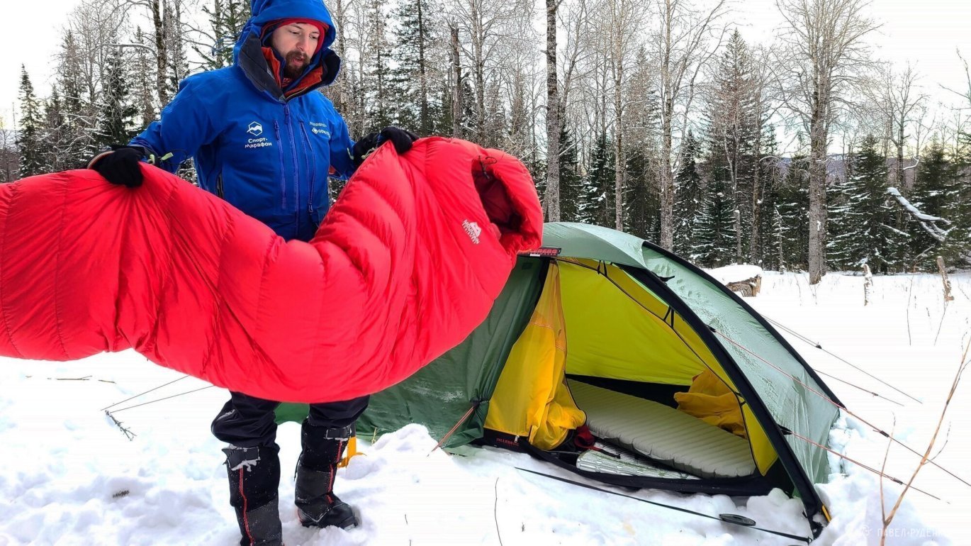
A tent with a larger vestibule in winter, it's very comfortable. More relevant for solo, because you sit in the tent while cooking anyway. The relevance is lost in a group, since in most cases a kitchen area is organized. Accordingly, a large vestibule is very relevant for team hikes in the tundra and open spaces.

Remove the elastic band from the backpack valve Klattermusen Tor 100L. I do not use them, and they cling to the branches when I drive past the trees at speed.
Thermal pants Sivera Snow, when moving they are good only colder than -15C. In warmer weather, thin thermal underwear with stretchy softshell with ventilation is suitable.
Walking Softshell Jacket is a bomb! I have never taken it off, all hikes in it, perfect choice. Breathes maximally well, blocks the wind.
Always tape the heel for blisters on a ski hike. I decided to experiment and not tape it because the boot fits perfectly and there were no problems on two day trips, but on the fourth day I got a blister. The system with a thin liner and a warm sock works great, but it is enough for the lacing to loosen for a couple of hours and the result is obvious) I will continue to tape the entire heel in the city as I did before and remove it upon returning home. If you have other problem areas, then tape wherever you can. It's harder to do it on a hike, colder and usually later.
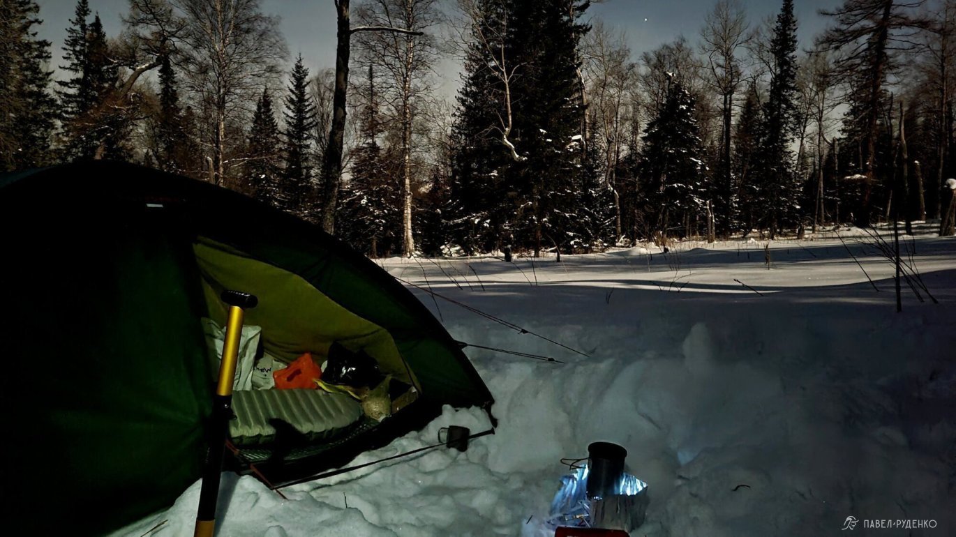
Put up a tent in the forest area. In winter hikes, if possible, put up a tent in areas closed by the forest zone, and not beautiful ones, which I usually do in the other three seasons. Wind and cold with low mobility in the camp are not much fun.
Fleece, thin gloves with completely cut off fingers for using a smartphone have not lived up to expectations. Other actions with iron and other objects freeze the fingers a lot. I also tried gloves with partially cut fingers, it's much better, but not ideal. I will look for thin fleece mittens with opening fingers.

Gear
- Hilleberg Unna Tent
- Mountain Equipment Glacier Sleeping Bag -35 down + silk liner
- Thermarest Xtherm Neoair Mat + Thermarest solar
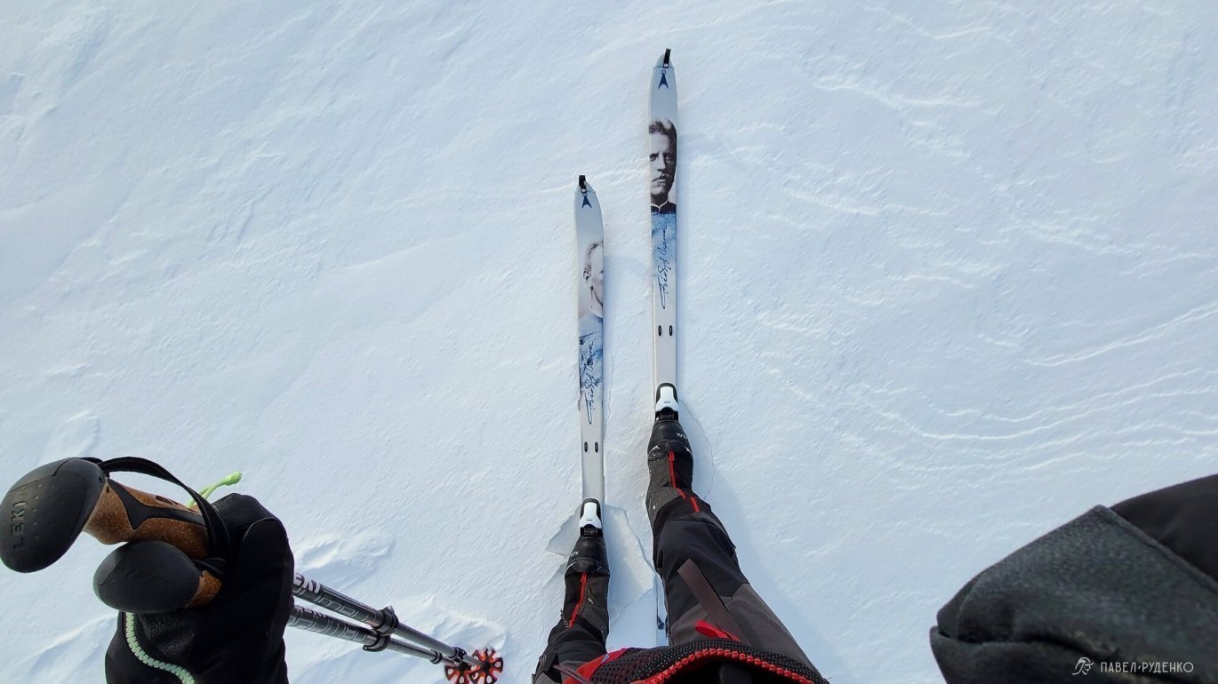
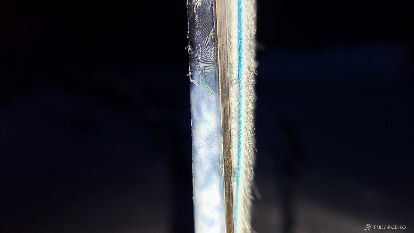
- Asnes Nansen Skis with notch + short nylon camus + long mohair camus (for testing)
- Leki Khumbu 145cm Trekking Poles
- Alfa Outback Boots
- Klattermusen Tor 100L Backpack
