
A detailed description of the Lycian Way, an article in 4 PARTS with the maximum amount of comprehensive information for an independent hike and stories that happened along the way: a dead cat in a water tank, a conflict with security and police near the Chimera fires, a thunderstorm cyclone in November.
The article is based on personal experience and is aimed at helping tourists. I tried to answer all the questions I asked myself: from choosing a route and time of year, situations with water, maps of the most beautiful places, to dangers in the form of snakes and scorpions.
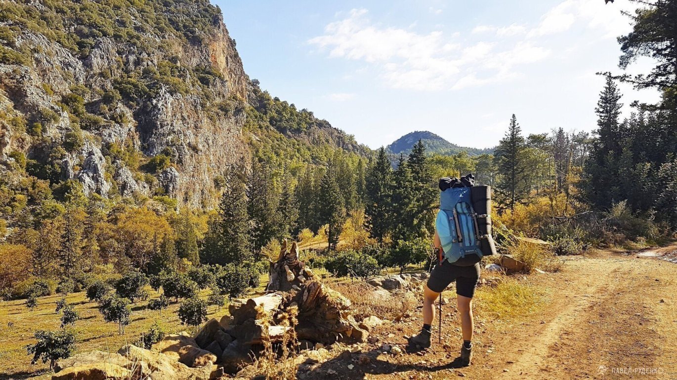
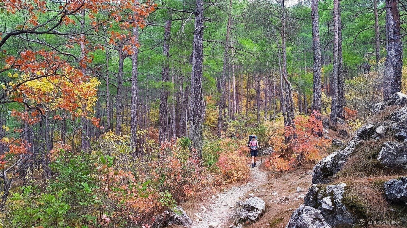
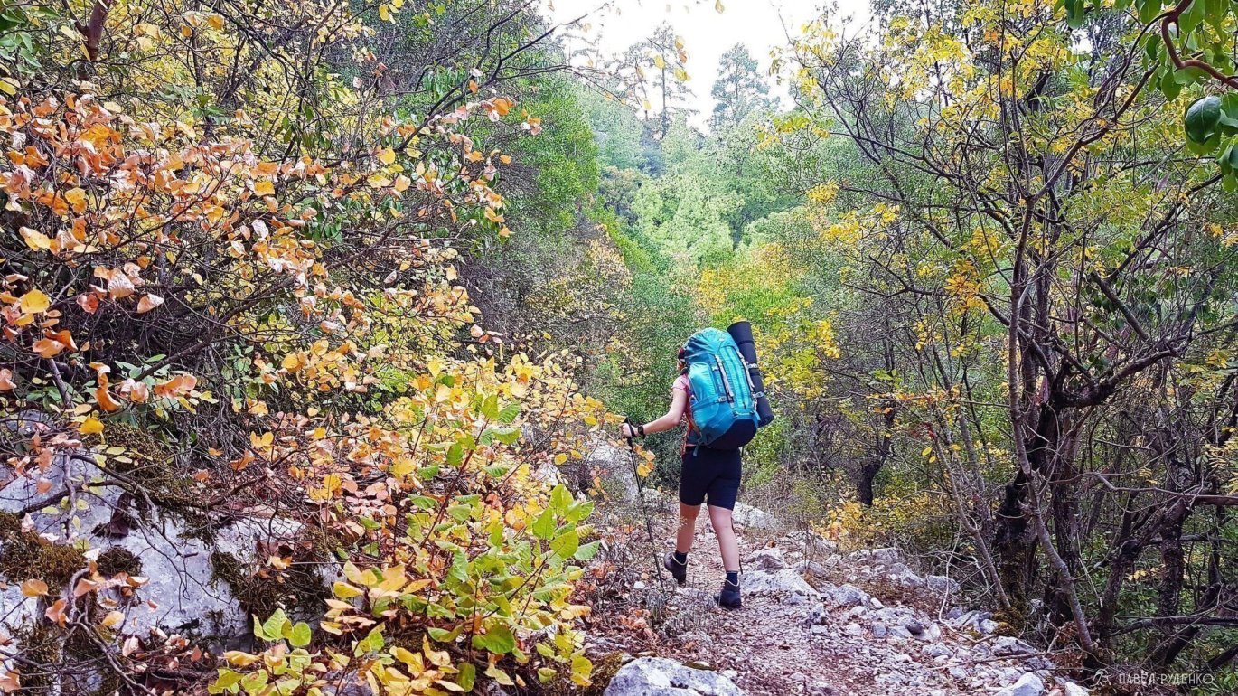
In November, my friend and I completed the eastern part of the trail. The article also includes useful information about the western and central parts of the trail.
Follow my Instagram, there's a lot of beautiful and useful content!
Hike date: 10.11-23.11 2018.
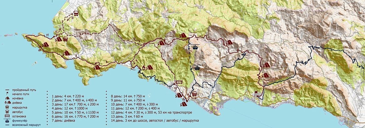
Distance covered: 130 km in the eastern part.
Duration: 11 days.
Route with elevation changes:
- Day. Gayнюк - overnight at the start of the trail, 4 km 220m up.
- Day. Overnight at the start of the trail - overnight in the riverbed, 7 km, 400m up, 400m down
- Day. Overnight in the riverbed - Gёdelme, 17 km, 700m up, 200m down
- Day. Gёdelme - overnight before the Tahtalı Dağ pass, at the unfinished guesthouse, 12 km, 1 000m up
- Day. Overnight on the Tahtalı Dağ pass - overnight after Beycik, 10 km, 50m up, 1.100m down
- Day. Overnight after Beycik - Old Mine Bay, 16 km, 770m down, 200m up
- Day. Rest day by the sea
- Day. Old Mine Bay - the top of Mount Olympos, 14 km, 750m up
- Day. The top of Mount Olympos - guesthouse Adriaslan or pine forest after the village, 11 km, 750m down
- Day. Guesthouse Adriaslan - overnight before the lighthouse, 7 km, 500m up, 300m down
- Day. Overnight before the lighthouse - Karaöz beach, 12 km, 200m up, 400m down
- Day. Minibus from Karaöz to Tekirova with a transfer in Mavikent, 53 km, 2 hours on the road. Tekirova - beach after the river, 4 km, 30m up, 300m down.
- Day. Beach after the river - overnight on a high cliff, 3 km, 60m
- Day. 3 km to the highway, hitchhiking/bus/minibus to Antalya.
Pros and cons
What makes the Lycian Way great? 10 points I formulated after the hike.
Pros:
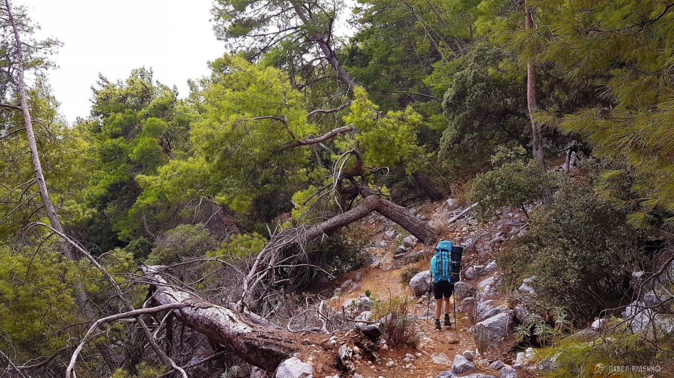
- Simple navigation. A hiking route along a well-prepared trail. The entire route is marked with red and white signs every 100 meters.
- Variety of styles. Solo passage, for beginners, trail running, speedhiking and hikes with children, trekking without a tent*. Not suitable for cycling: the trail is rocky, with obstacles in the form of fallen trees and elevation changes. Cycling routes are built parallel to the Lycian Way along an asphalt road with access to interesting areas and the sea. *A hike without a tent is possible with overnight stays in guesthouses, except for one overnight stay in the central part of the Demre – Fınikë trail. This is official information from the book by the creator of the trail, Kate Clow. Of course, hiking without a tent is only possible in the high season, in late spring and early autumn; the rest of the time, the guesthouses may be closed.
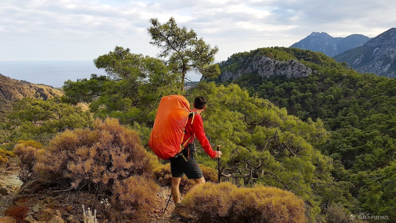
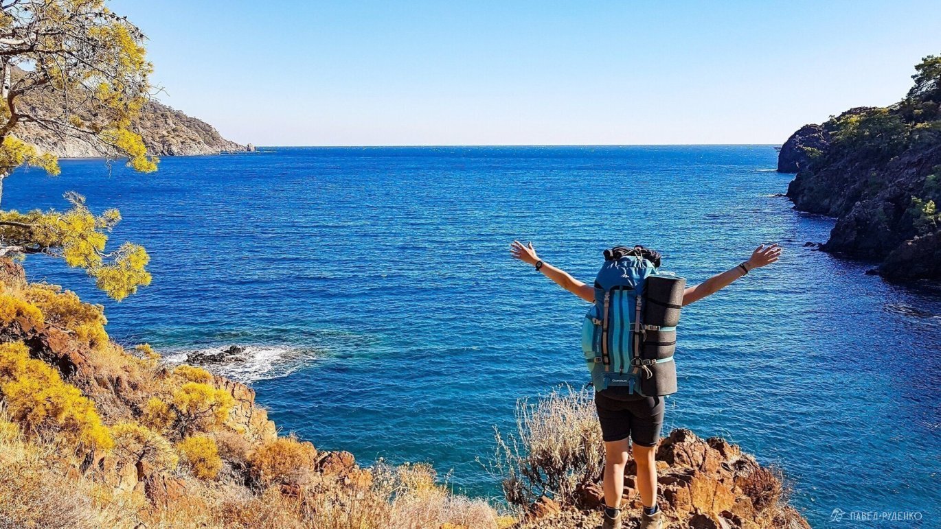
- Sea and mountains in one route. The trail runs along the coast with beaches, periodically moving into the mountains. Many bays and places for wild camping by the sea, there are equipped drinking fountains.
- Long route. The total length of the route is 540 km. Long-distance hikers complete the entire route in 25-30 days, but most go to the eastern or slightly less popular western part. Typically, for 5-12 days, covering 70-200 km. Convenient logistics with buses in the villages. Lovers of one-day hikes can walk along nearby sections of the trail and return to the guesthouse.
- Long season. The route can be completed almost any vacation. In her book, Kate talks about favorable months from February to June and from August to November, but it is also possible to hike in winter and summer. Below is a chapter on the weather and the best time for a hike.
- Beautiful route. According to The Sunday Times, this Sunday edition of The Times, the trail is included in the top 10 most beautiful trails in the world. Preparing for the hike, I often came across this statement. The trail is certainly beautiful, but, objectively, it ranks among the top 50 beautiful routes in the world.
- Affordability. Cheap tickets for Russia and the CIS. My flight Moscow-Antalya-Moscow in November cost 8,500 with luggage. No visa required for citizens of the Russian Federation, Ukraine, Belarus, Kazakhstan.
- Suitable for beginners. Low difficulty of passing the trail, but due to the elevation changes, it requires average physical fitness. Every 1-2-3 days, there are villages with shops on the way, plus it's an opportunity to return to civilization, interrupting the route.
- Versatile. Can be combined with entertainment, such as paragliding, diving, kayaking, rock climbing and rafting.
Cons:
- Paid sections. The trail passes by attractions, ruins that may not be interesting, but require payment. A total of 500 rubles per person in the eastern part. Below there will be information on how to bypass paid sections.
- Garbage. Some beaches and bays were dirty. A lot of garbage on the Giledonia lighthouse. The places themselves are very beautiful and secluded, but the garbage somewhat spoiled the overall atmosphere.
SUMMARY: An easy route for beginners, budget flights and easy transportation. Camping on the beach, swimming in the azure waters of secluded bays. Warm and dry climate with hikes almost any time of the year. Diverse landscape from sea to mountains. Delicious fruits along the entire trail. Marked and safe route.
Weather
In her book, Kate Clow writes that you can hike the route from February to June and from August to November. After completing the route, analyzing the weather history for the past 7 years and the experience of other hikers, I determined the most favorable time of the year with minimal rainfall and a comfortable temperature of 22-26 degrees.
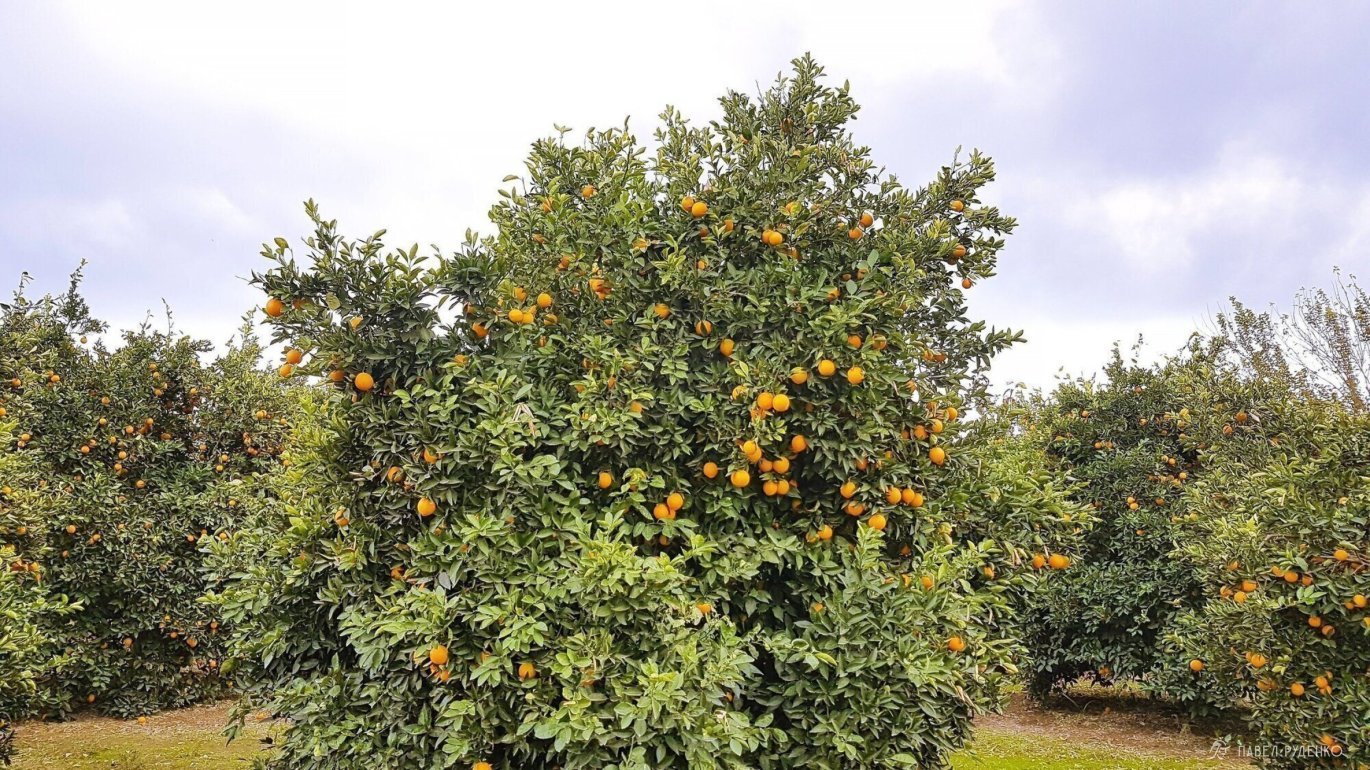
In spring. This is from April 5 to May 5 (+20°-25° during the day, +10°-15° at night at an altitude of 0 m above sea level. Above 1,500 m, there may be snow. Trail marks will be hidden under it, be sure to use GPS. In March, there are still a lot of showers and it's cool, and by mid-May, the temperature rises to hot +30°. A good time to see everything turn green and flowers bloom. From April to May, it's the season for oranges, loquats, and mulberries. Plenty of drinking water along the route.
If you are flying through Istanbul, then in April there is a tulip festival, a beautiful sight.
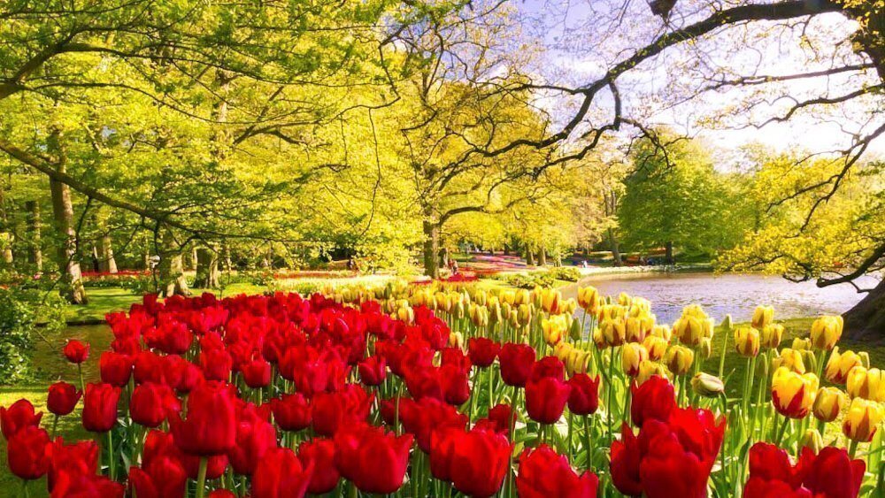
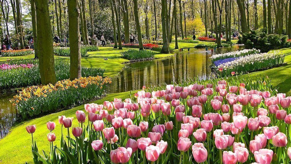
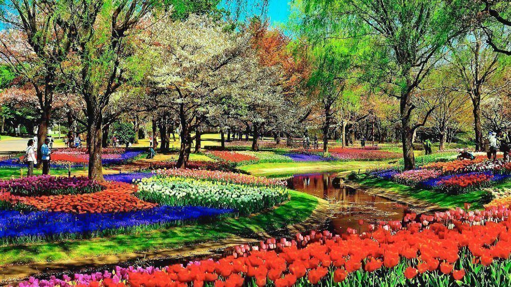
Photo from open sources, the author could not be found.
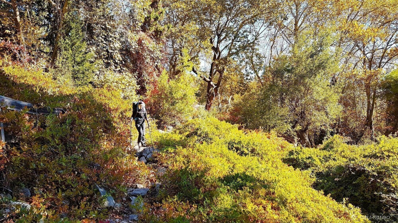
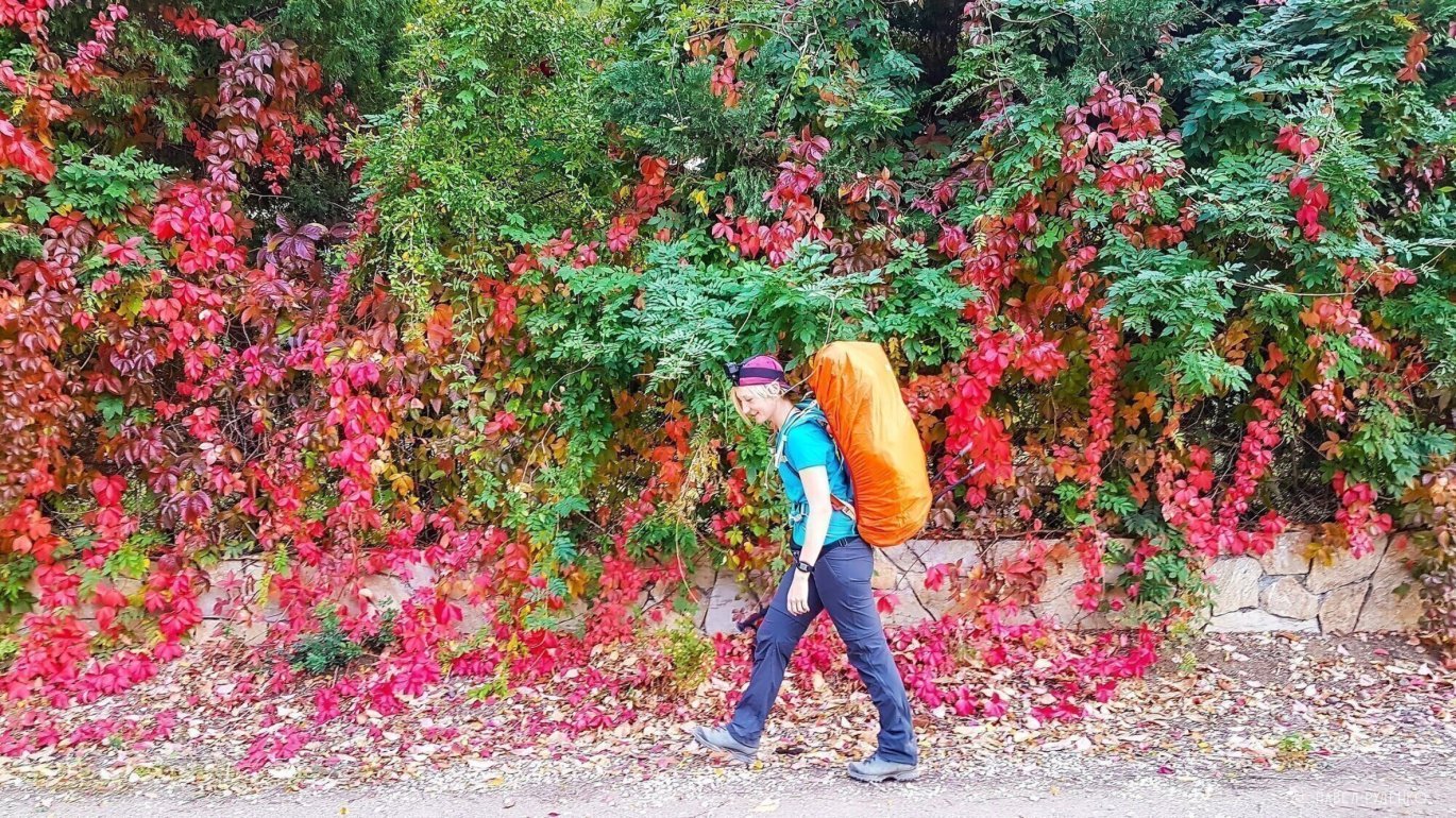
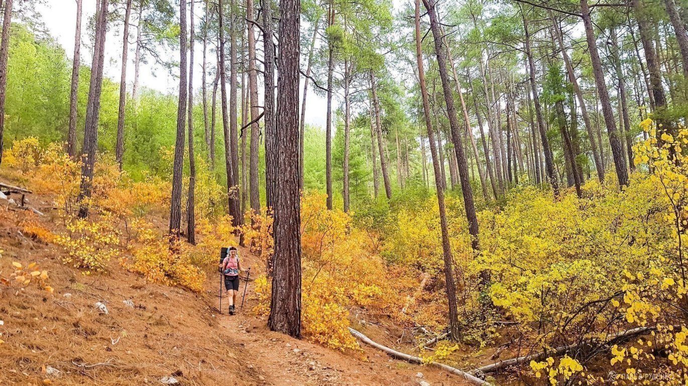
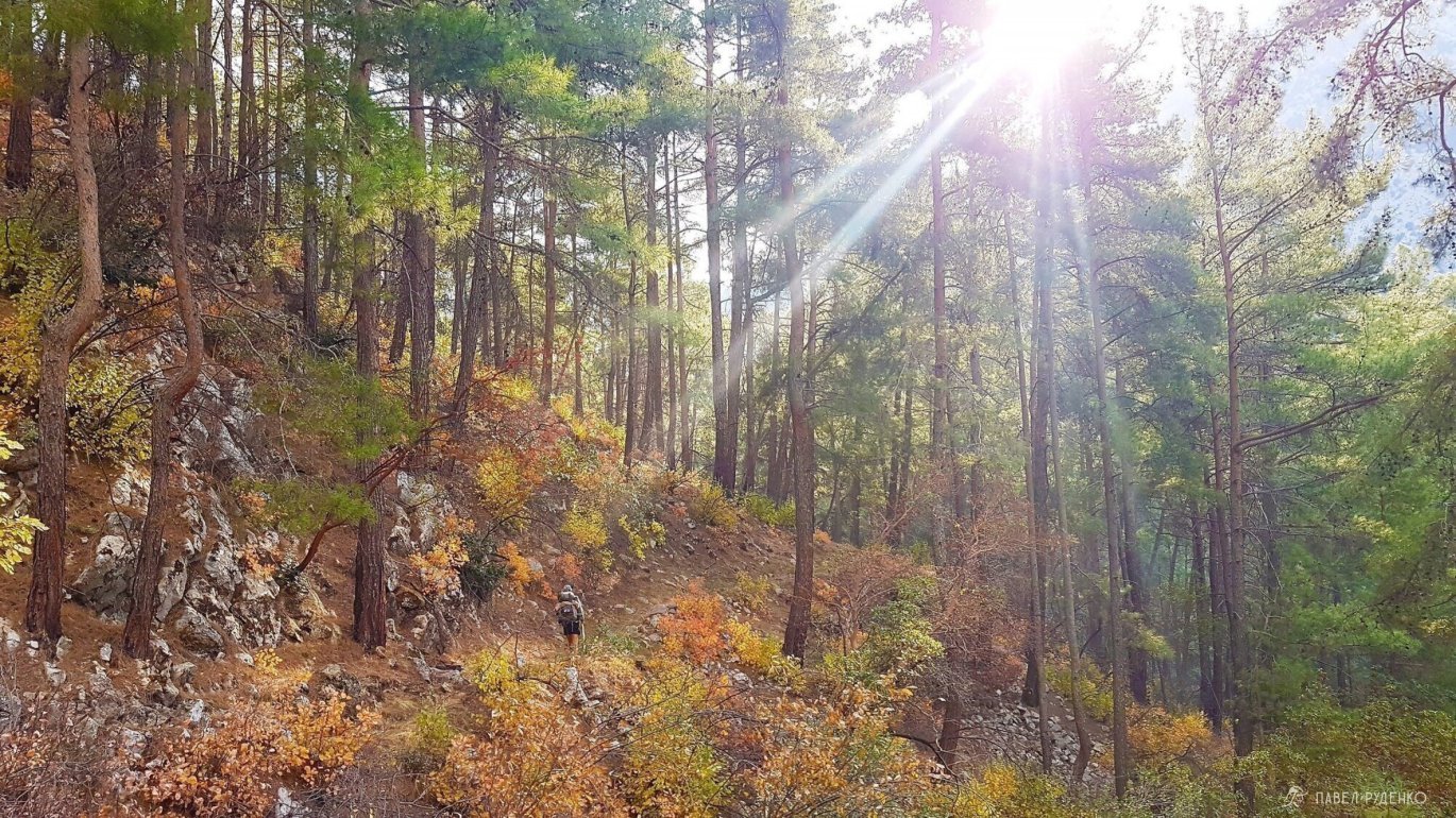
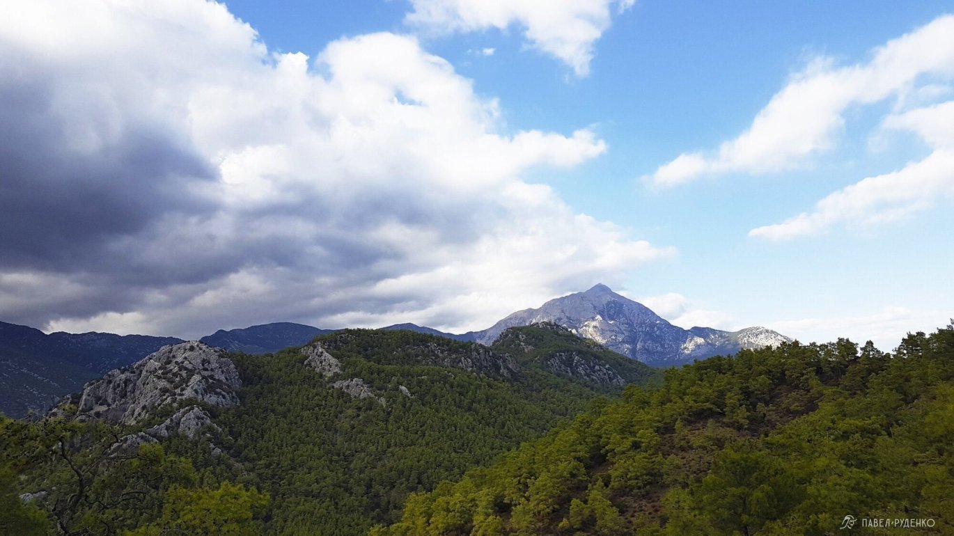
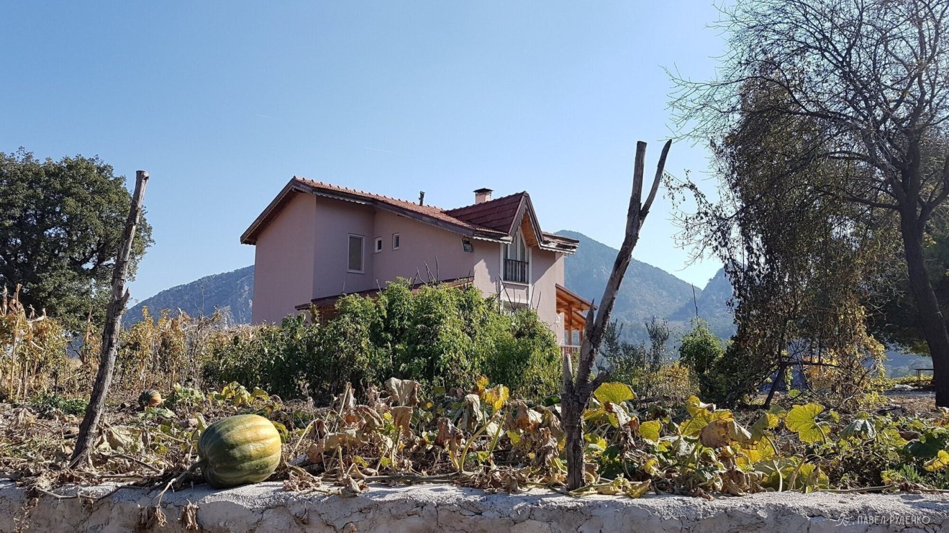
In autumn. From October 1 to November 5 (+24°-28° during the day, +10°-19° at night at 0 m and +19°-26° during the day and +5°-10° at night at 1,000 m above sea level. In the mountainous area, there can be strong fogs and clouds. The entire route is colorfully variegated with green-yellow colors, I really liked the simultaneous crunch of dry leaves and admiring the lush greenery.
If you want to swim in comfort, check when the water temperature exceeds 25 degrees. The beaches are mostly pebbles, take care of your feet – there are often sharp stones at the bottom, a deep wound on the foot can jeopardize further hiking.
In summer. Exhausting period: drinking sources dry up, especially in the central part, as there is mostly stagnant water in wells and tanks. From June to August, the temperature often rises to +40°, and the lack of shade makes this time uncomfortable for hiking. The surrounding nature is scorched by the sun, not as beautiful as in other seasons. There are few people on the route.
It is not worth going during the month of Ramadan. The next dates are May 5 – June 7, 2019, and April 23 – May 26, 2020. Stores and restaurants may be closed during the day. And after Ramadan, the holiday and revelry continue for another 4 days. Also, on my last trip to Turkey by hitchhiking, I encountered the fact that truck drivers cannot enter large cities like Istanbul during holidays. Do not forget that the date of Ramadan always shifts. Just google "Ramadan date in Turkey". Also, during Sheker Bayram and Kurban Bayram, transport, beaches are crowded, and stores may be closed.
In winter. As a rule, during the January holidays. At this time, it is better to go with experience in winter hikes. It should be taken into account that from mid-December to early February, strong storms and snowfalls are possible. Above 1,000 m, snow and trail marks will be hidden, it is necessary to use a navigator. On the upper section of the pass, you will have to trope through a meter of snow. About 30-50% of the days there is precipitation. The river at the Gaynyuk Canyon is heavily flooded, most likely you will have to wade through it, the water can be waist-deep. If the current is too strong and the water level is high, you can go around from Kemer to Gadelme. In this regard, it is necessary to monitor the forecast and be mentally and physically prepared. Have the necessary gear, and if necessary, change the route thread, take a safer path. In winter, most guesthouses and cafes are closed. Some stores are open. There are practically no people on the mountain sections of the trek.
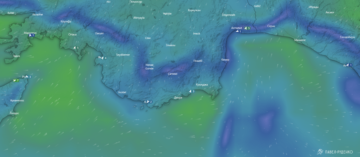
The weather near the sea is changeable, due to the terrain, the wind direction is different in each area. The temperature can differ by 5-7° within a radius of 30 km. Information from the Windy.com website.
When climbing every 1,000 m, the temperature on average decreases by 8°.
In Turkish sources, I found a recommended weather forecast website for Turkey: www.wunderground.com. It is convenient if you want to know in advance the approximate temperature for your trek dates. Enter the nearest city to the route, select Full Forecast (full forecast) -> History (history) -> Monthly (month). Study the temperature, precipitation, and forecast the weather for your trip.
On the trek itself, I always use meteoblue.com. Very detailed forecast, amount of precipitation and their probability, direction and wind strength for different altitudes. When hovering the mouse over the icon, it shows what the indicator means. On the trek, you need to take the weather seriously, because we are in an unfamiliar climate, at unusual altitudes, often visual observation is erroneous and insufficient. I always buy a local SIM card to check changes every 1-2 days, there is Internet almost everywhere in Lycian, more details about this will be in another section.
Water
There is enough water on the route. The sources indicated in Maps.me correspond to reality. Plus, you can ask for drinking water from locals or in mosques.
In July, August, and September, there may be no water in tanks and wells, they are found in the central part and are marked on the map (Cistern).
From June to the end of October, you should be careful with water. This is the time for grazing livestock to distant pastures. In addition to mandatory boiling, you can use a filter, disinfectant tablets, and iodine.
In the eastern part, on the section from Adrasan to Karaoz, there is no water. Before crossing, you should stock up on the required amount. For 2 people, we took 5 liters with the expectation of spending the night at the lighthouse: 1.5 liters for dinner, 1.5 liters for breakfast, and 2 liters for the day of walking and the next morning. Plus a lot of fruit. The water in the tank at the lighthouse was spoiled. Fortunately, a note was left:
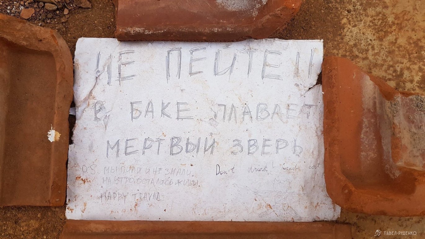
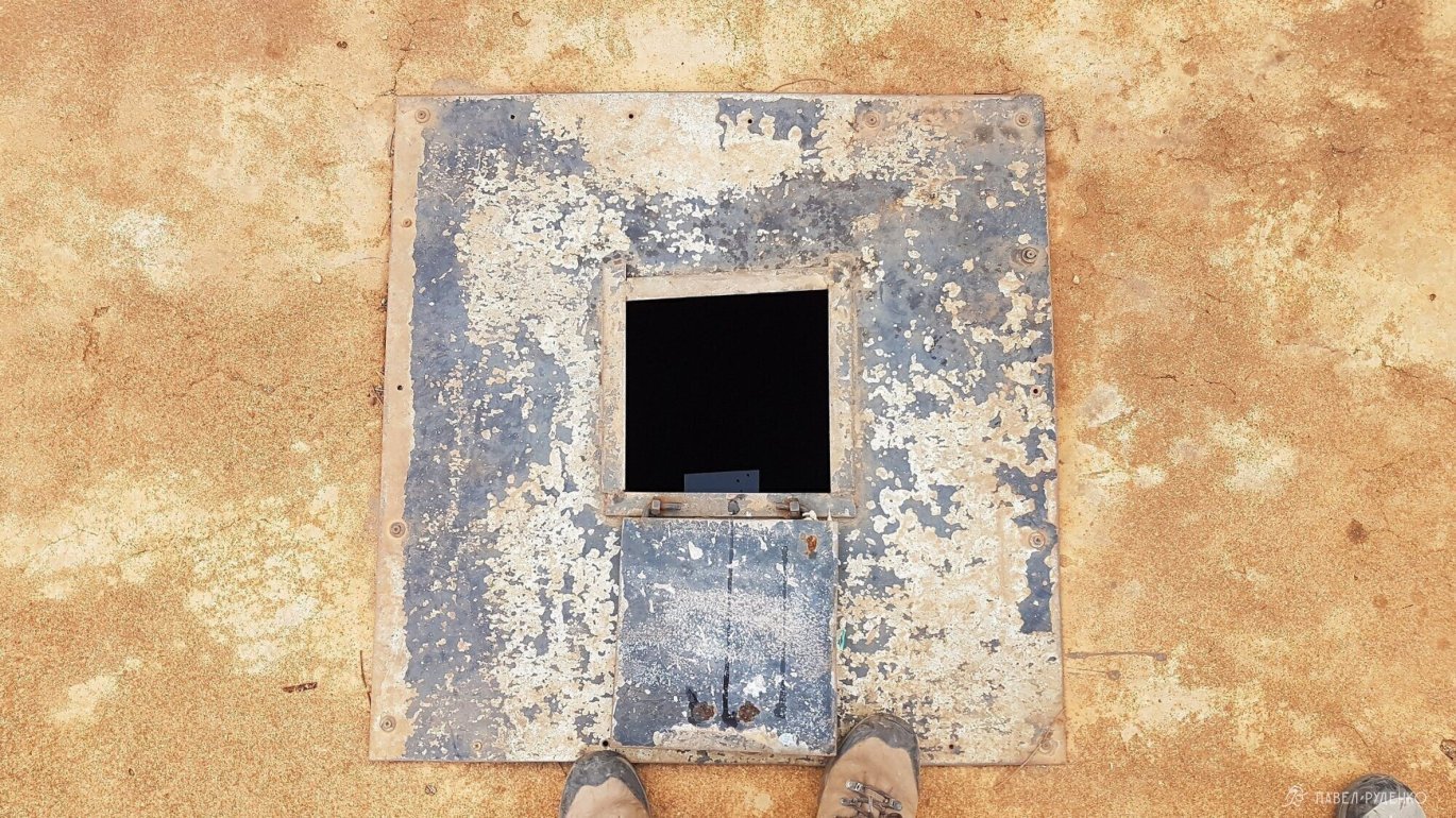
The tank is poured into concrete and located at the end of the lighthouse.
In general, the story is as follows: a month ago, a cat got into the tank, the little animal could not get out on its own. After a couple of weeks, rumors of this reached the locals, a Turk came to check, took out the cat, and concluded that the water was fine, it was safe to drink…)))
When I looked inside with a flashlight, oh, how I cursed! There is a lot of garbage floating inside – from chip packets and bottles to organic matter. No one cleans the tank, and the water collects during rains. You should drink from such tanks with caution. The nearest drinking source was two hours away, in Pirate Bay (Korsan Koyu).
I recommend taking a filter with you: often the water has mechanical sediment and tastes bad, both in urban drinking fountains and on the route.
For this trek, I bought an Aquaphor filter that fits on the bottle neck. Convenient, cheap, did the job.
All active sources are indicated in Maps.me, but some may dry up. The higher in the mountains, the cleaner and tastier the water. The closer to the sea coast, the worse: a salty taste and smell appear. I filtered such water and sometimes boiled it additionally.
In other areas in the eastern part, I came across 1 to 3 sources during a day of trekking. These are streams, drinking fountains, underground waters brought to the road by pipes.
I did not tie the stops to the water – I prefer beautiful views, so I took the right amount and carried it with me, usually 3 liters.
Tanks and wells that look like stone slabs are not always noticeable. This is not a cozy well in grandma's garden! Sometimes worn-out ropes break, or the water simply cannot be reached from the bottom of the tank, so you should take some climbing rope with you. You can dry things on it, and replace torn shoelaces with it.
Food and stores
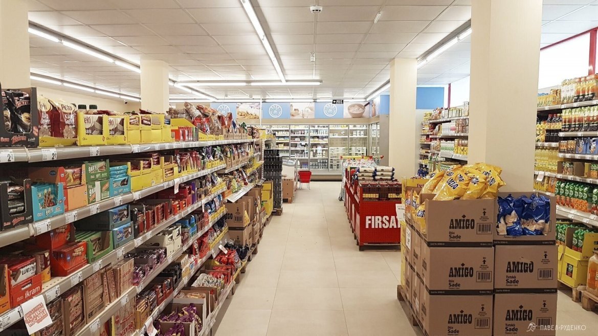
Every 2-3 days there will be small shops with basic necessities. You can buy bread, cheese, milk, ketchup, sausages, less often sausage and frozen chicken. For a side dish – rice and pasta. There is a large selection of cookies, fruits, vegetables, batteries, tape, and other small items. There is no oatmeal, sir, or other cereals. There are no instant meals either, except for non-nutritious powdered soups. Therefore, you need to buy the rest of the products in advance. There is no normal meat, take homemade заготовки, pemmican, basturma, сублиматы, protein shakes, etc.
There are no price tags in stores, I was cheated in one of them. Find out the cost of each product and recalculate at the checkout yourself.
Stores in the eastern part: in Gaynyuk – in Gedelme, Beycik (the seller cheated on the price), Cirali (3 stores with a good selection at the entrance to the village and in the central part), Tekirova (a large store by local standards at the entrance to the town.), Kemer (Large store, civilization), Adrasan (in mid-November, stores and cafes were closed, managed to reach one of the owners), Karaoz (excellent minimarket).
Wonder pasta in the form of rice, called Piyale Arpa Senhriye, is a very tasty thing, I recommend it. Cooks in 20 minutes, 30 rubles for 500 grams.
Fruit seasons:
Winter: citrus season.
April: golden medlar (beginning of the season), strawberries, black mulberry, orange (end of the season).
May: cherries, strawberries, oranges, medlars.
June: medlar, apricots, cherries (beginning of the season), plums, nectarines, melons (beginning of the season).
July: watermelons (beginning of the season), melons.
August: pears, early grapes, apples, peaches, figs (beginning of the season), watermelons.
September: watermelons, pomegranates, figs, grapes, peaches.
October: oranges (beginning of the season), lemons, persimmons, quince, pomegranates, avocados, tangerines.
Taken from the Internet, I didn't find the author.
Route selection
5 options for completing the Lycian Way:
1. The entire trail: 540 km, 8-30 days. Depends heavily on your speed and style of travel. Usually from west to east, from the city of Fethiye to the village of Geikbayyry. The reverse option is also possible, with some sections having longer descents and others having ascents.
2. Western part. Worth doing for the beaches and bays, more civilization along the route. There are places for diving: people on the route said that diving is very cool and cheap.
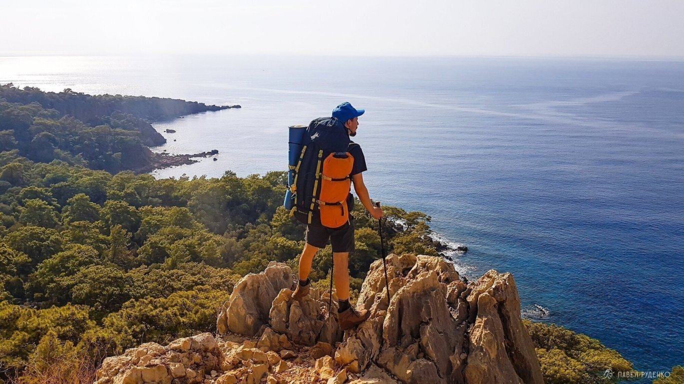
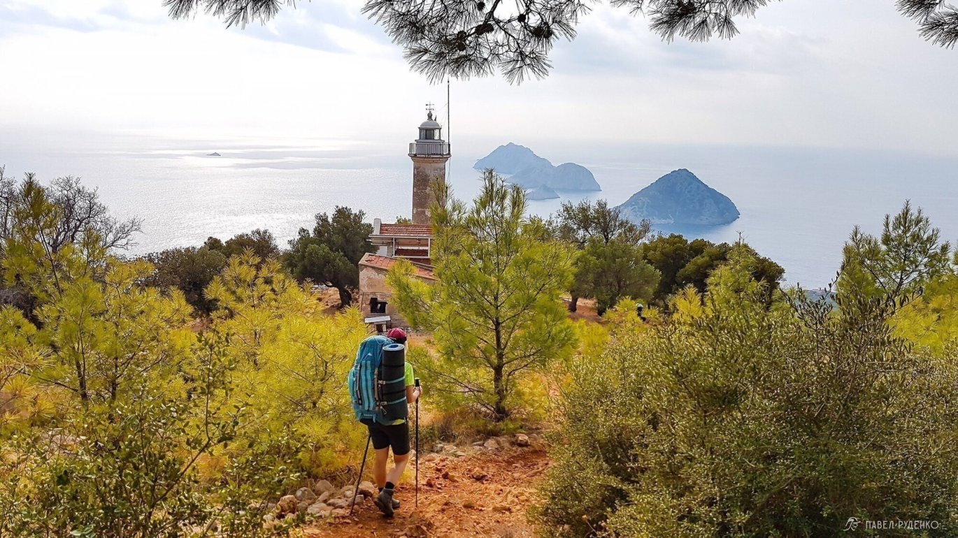
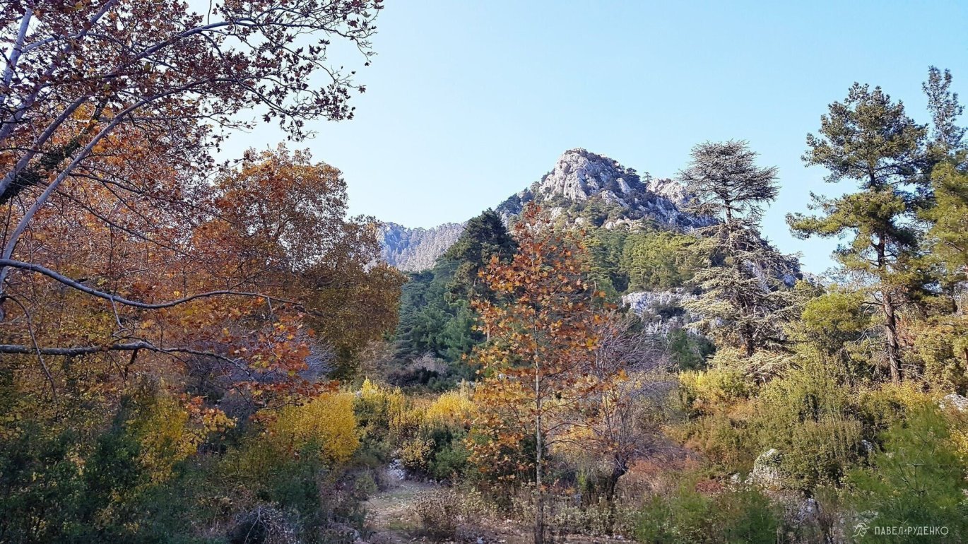
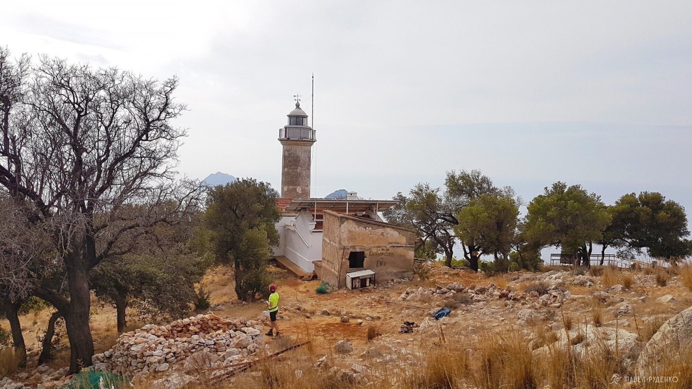
3. Eastern part. The most popular section, a more mountainous route, passes through the highest point of the Lycian Way – Mount Tahtaly Dag. At the beginning of the route, you can go rock climbing. In a place called Geikbayyry, there are many trails and gear rental points. There are sections passing through the beach and cool bays between the villages of Chıralı and Tekirova. Beautiful Cape Gelidonia with an old lighthouse.
4. Central part. An unpopular section: many roads, water issues, thorns. If you are traveling without a tent, the section from Demre to Finike, which is 40 km with elevation changes, must be traveled by transport, as there are no guesthouses.
5. One-day hiking. If you are not ready for a full-fledged trek, it is very comfortable to do short outings here. You walk along the nearest sections of the trail and return to your own guesthouse. If you are ready for travel, you can divide your vacation time between a couple of cities and see more attractions. For example, in Chıralı, you can see the fires of Chimera, visit the ruins of Olympos and the bays towards Tekirova. In Karaoze, you can reach the lighthouse on Cape Gelidonya and the pirate bay near the city.
The article is divided into 4 PARTS for convenience, you can go to the next part below.
Also watch my lecture about the Lycian Way at the Sport-Marathon Travel Club!
Continuation in the following parts:


